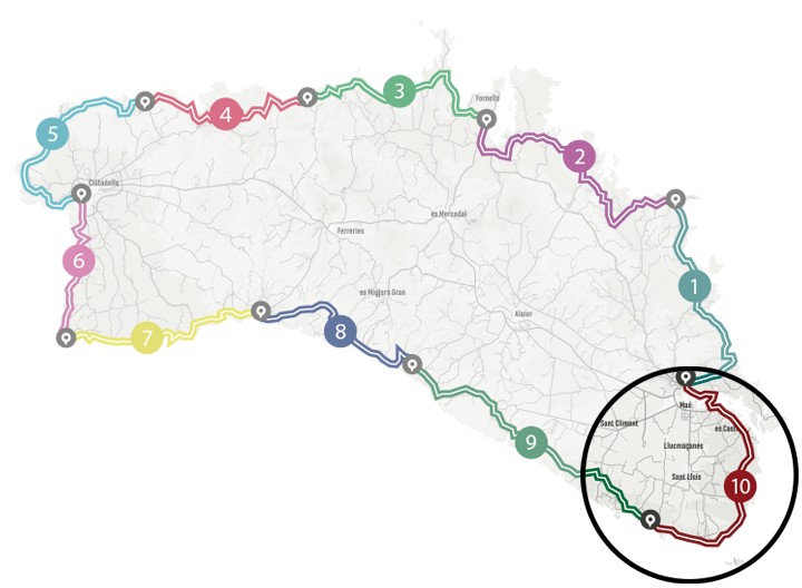
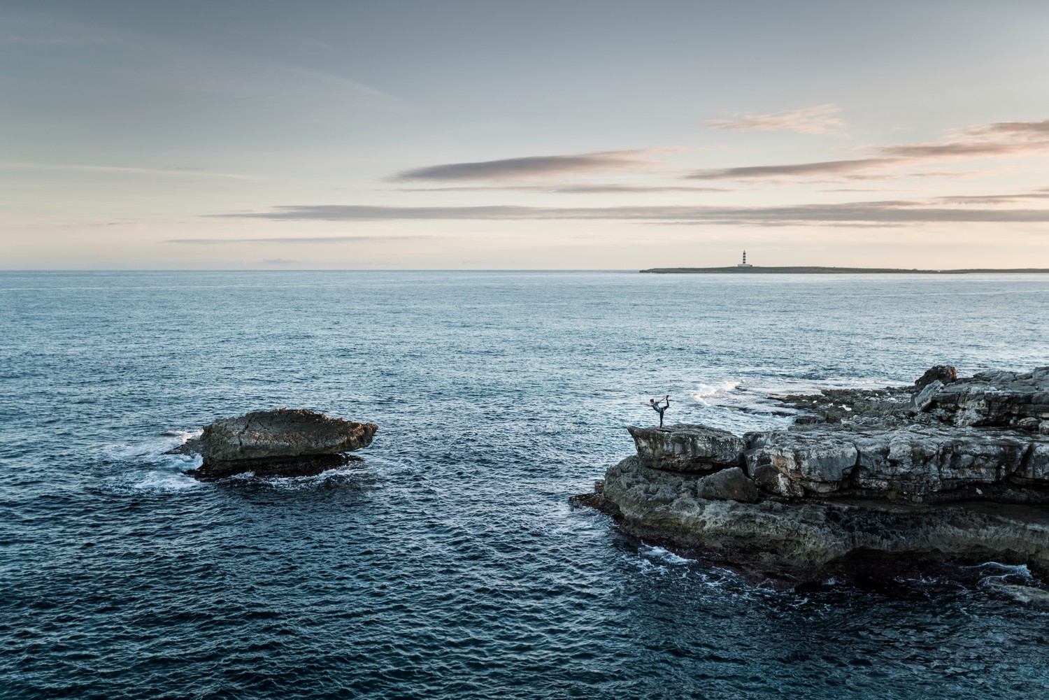
The route comes to an end, once again in Maó, after having gone all the way around Menorca. A good part of this last stage runs through urban terrain, although there are still charming coves such as Biniancolla, Alcalfar or Rafalet. In addition, it is worth enjoying the views of Illa de l’Aire and its lighthouse, off the coast of Punta Prima.
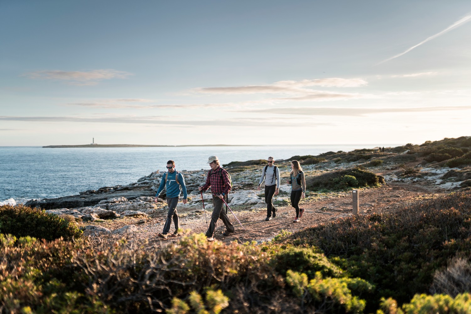
Camí de Cavalls 360º offers a good number of modalities, formulas and formats for participants to enjoy the route with a path adapted to their pace, level and time availability. The Hiking and Trekking 10 stages program is one of the best suited to hikers with some experience and looking for medium difficulty routes.
The 185 kilometers of distance and 2,741 meters of elevation gain are divided into ten feasible days of about twenty kilometers on average. Participants should only think about enjoying the landscapes and spots through their path. The organization team will take care of the rest: advice on the route and possible variants, logistical issues and even transfers to accommodation when it is not possible to reach them walking.
STAGE #02: FAVÀRITX – SES SALINES DE FORNELLS
STAGE #03: SES SALINES DE FORNELLS – CAMÍ DES ALOCS
STAGE #04: CAMÍ DES ALOCS – CALA MORELL
STAGE #05: CALA MORELL – CIUTADELLA
STAGE #06: CIUTADELLA – CAP D’ARTRUTX
STAGE #07: CAP D’ARTUTX – CALA GALDANA
STAGE #08: CALA GALDANA – SON BOU
STAGE #09: SON BOU – BINIBÈQUER VELL
STAGE #10: BINIBÈQUER VELL – MAÓ
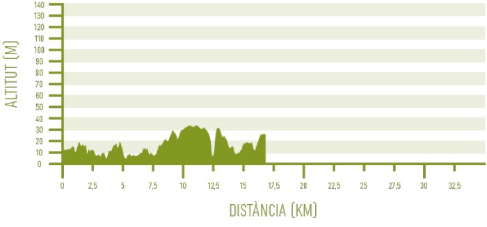
Distance: 17,69 km / Elevation gain: 112 m
The last kilometers of this journey around the island pose few technical difficulties. In addition, it is one of the shortest stages and with the least elevation gain of the entire route, so participants can take the opportunity to enjoy the last landscapes before finishing. However, you must pay attention to the signs of the Camí de Cavalls, since they can be especially easy to miss on pavement and street areas.
From Binibèquer Vell to Alcalfar
Between Binibèquer Vell and Binibèquer Nou lies the Cala de Binibèquer, which has maintained a look of unspoiled beach with its fine white sand and crystal clear waters. Although the Cala de Biniancolla and its small port are probably one of the most charming points of this first section.
Next, you will reach the Punta Prima residential area, where you can visit the defensive tower of Son Ganxo (18th century) and enjoy the views of Illa de l’Aire, where its lighthouse alerts sailors about the southeastern tip of Menorca.
The profile is almost flat as you cross Platja de Punta Prima and follow the coastline through a landscape of rocky areas and a low sea of junipers and mastic towards Cala d’Alcalfar. Before arriving, you can see the Torre d’Alcalfar (1786), restored a few years ago.
From Alcalfar to Cala Sant Esteve
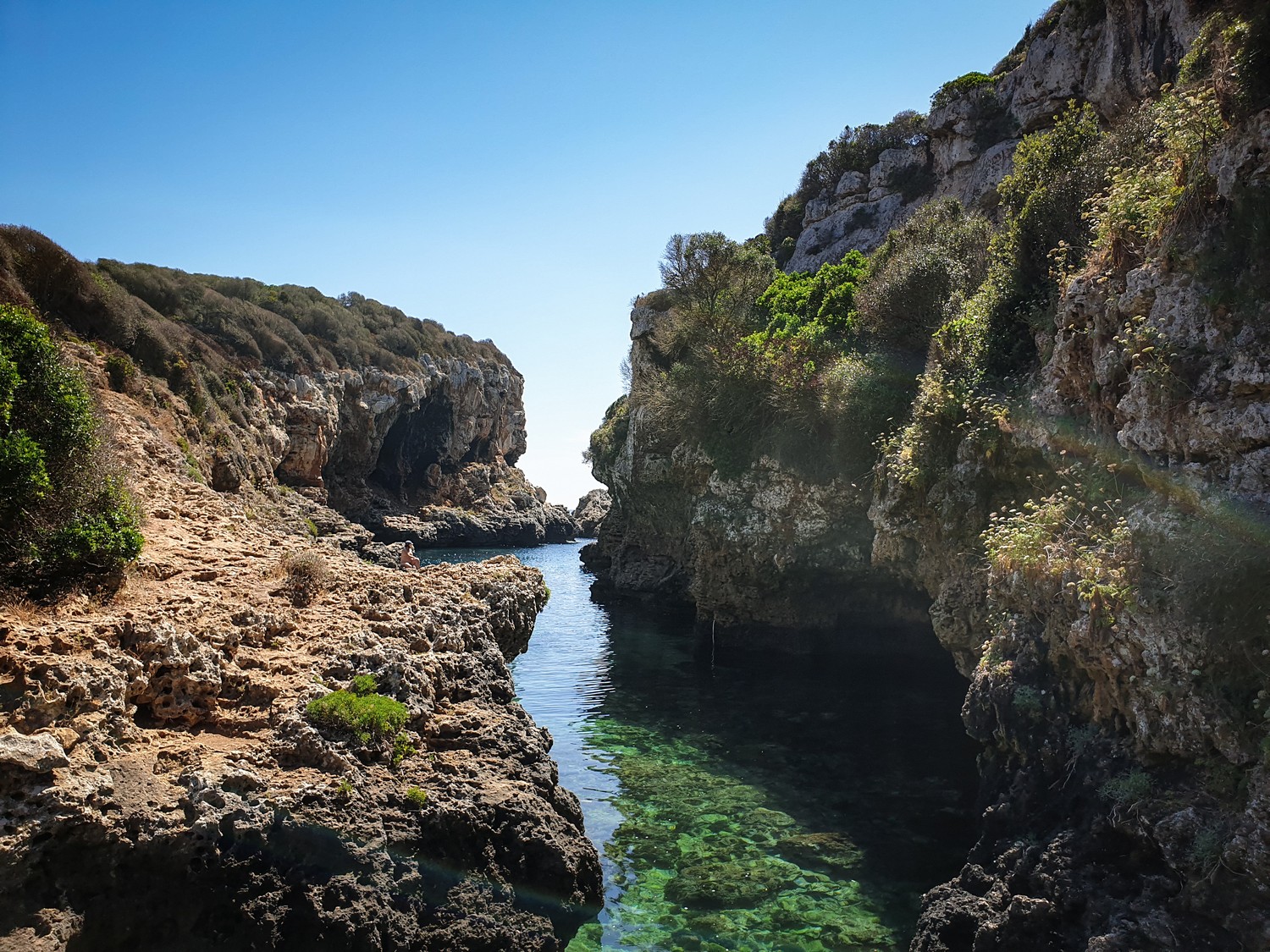
After crossing the access roads to Alcalfar and S’Algar, a wide track leads to the Barranc de Rafalet ravine and the detour to the namesake cove, which is picturesque and with transparent waters, tightly squeezed between two cliffs. The ravine is also of interest, mainly because of the dark holm oak wood that covers it.
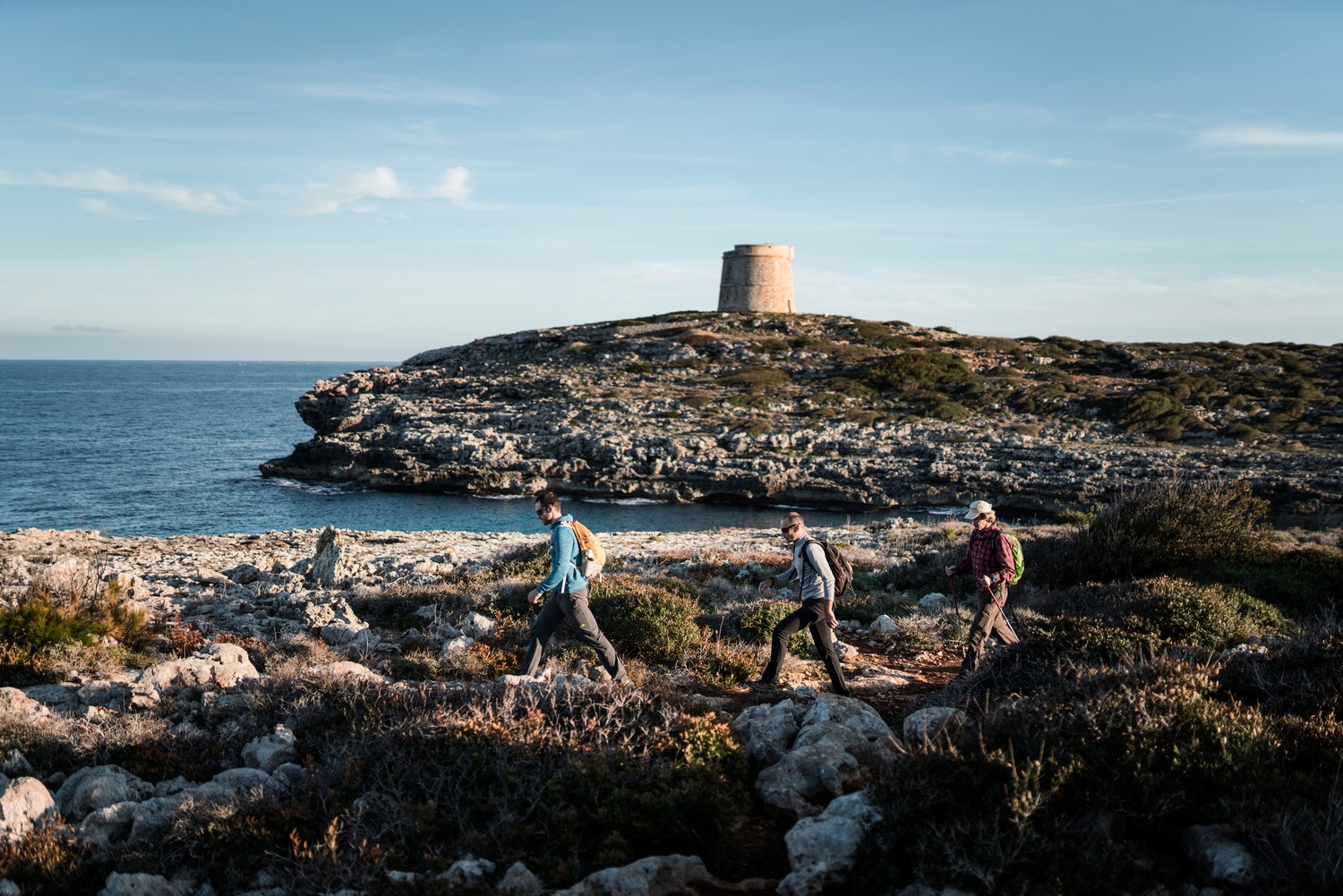
From here, pastures and crops alternate with wild olive forests, as the tour goes inland thorugh long stretches of path embedded between high dry stone walls up to Cala Sant Esteve. Before reaching the cove, however, it is advisable to take a detour through an opening in one of those walls to reach the Torre d’en Penjat (1798), from where you get a magnificent view of the mouth of the Port of Maó and of the Fortalesa de La Mola fortress.
Cala Sant Esteve is surrounded by two fortifications designed to defend the Port of Maó: the Marlborough fort, built by the British between 1720 and 1726, and the Sant Felip castle, dating from the 16th century.
From Cala Sant Esteve to Maó
From here, everything is pavement until Maó. You must always continue along the access road to Cala Sant Esteve and pass through the outskirts of the center of Es Castell. This town, created by the English to free the areas closest to the Sant Felip castle of inhabitants in 1771, offers good views from its cliffs and hides the cozy Calesfonts, a small port with marine atmosphere where you can see the old fishermen’s caves, nowadays converted into restaurants and shops.
Maó is the end point of the stage and the route. If at the beginning there was no time to discover its spots, it is worth spending a little time in the city. The archaeological origin of Maó dates from about 1500 BC, during the Talayotic era, and its name comes from the Carthaginians. Its current configuration corresponds to the first period of English rule, from 1713 to 1756, nuanced by its original Mediterranean charm. Today it is the administrative capital of Menorca, it has a rich historical heritage and great social, economic and cultural life.
The Camí de Cavalls crosses the urban grid of Maó to link up again with the starting point. During the journey you can admire its urban landscape, its views of the port, as well as some of its monuments and parks. Even before fully entering the city, the path passes in front of the entrance gate of the Hospital de l’Almirall, a colonial-style house that was adopted as a residence by the English admiral Collingwood in 1809. Further on, you can visit the Museu de Menorca, located in the old Franciscan convent of Jesús, originally from the 15th century, although its current appearance corresponds to the reconstruction of the 17th and 18th centuries. Other notable monuments –in addition to those mentioned in stage 1– are the Military Government, originally the Casa del Rei and later converted into the palace of the English governor, and the portal of Sant Roc (1359), from the old walls of the city.