Menorca shows a new face in this section of its southern coast. The ravines are the main actors of this stage, which also links three important tourist settlements such as Cala Galdana, Sant Tomàs and Son Bou. The second half of the trail is an introduction to a flatter section of the island’s coastline, leaving cliffs and rock behind.
Camí de Cavalls 360º offers a good number of modalities, formulas and formats for participants to enjoy the route with a path adapted to their pace, level and time availability. The Hiking and Trekking 10 stages program is one of the best suited to hikers with some experience and looking for medium difficulty routes.
The 185 kilometers of distance and 2,741 meters of elevation gain are divided into ten feasible days of about twenty kilometers on average. Participants should only think about enjoying the landscapes and spots through their path. The organization team will take care of the rest: advice on the route and possible variants, logistical issues and even transfers to accommodation when it is not possible to reach them walking.
STAGE #02: FAVÀRITX – SES SALINES DE FORNELLS
STAGE #03: SES SALINES DE FORNELLS – CAMÍ DES ALOCS
STAGE #04: CAMÍ DES ALOCS – CALA MORELL
STAGE #05: CALA MORELL – CIUTADELLA
STAGE #06: CIUTADELLA – CAP D’ARTRUTX
STAGE #07: CAP D’ARTUTX – CALA GALDANA
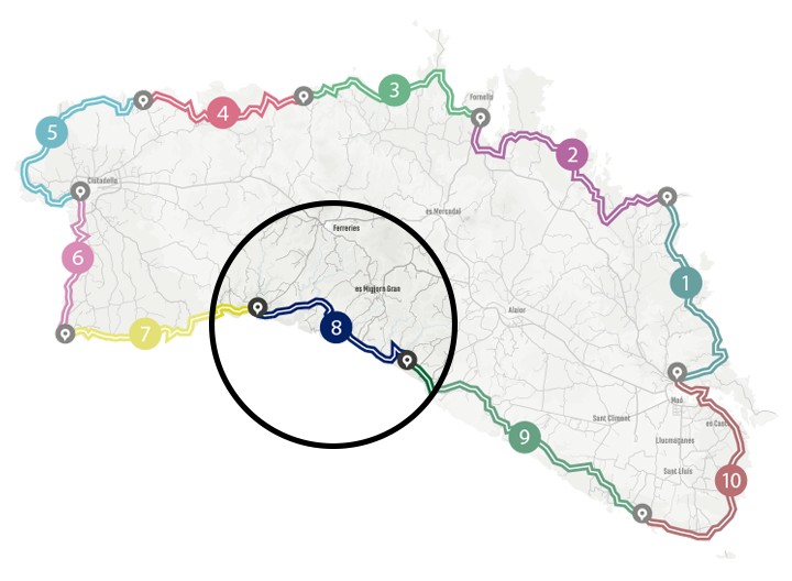
STAGE #08: CALA GALDANA – SON BOU
STAGE #09: SON BOU – BINIBÈQUER VELL
STAGE #10: BINIBÈQUER VELL – MAÓ
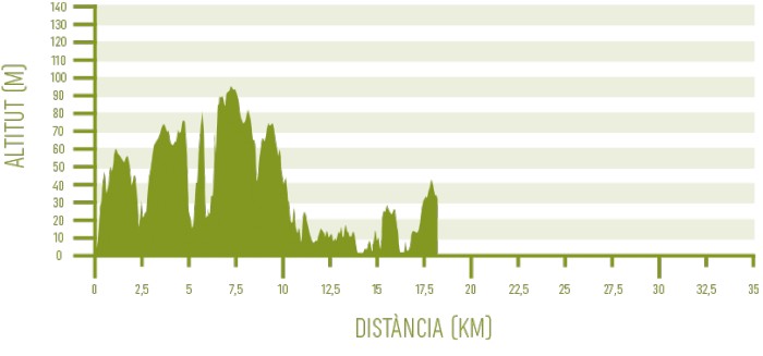
Distance: 17,85 km / Elevation gain: 278 m
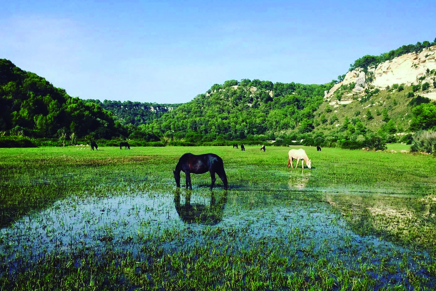
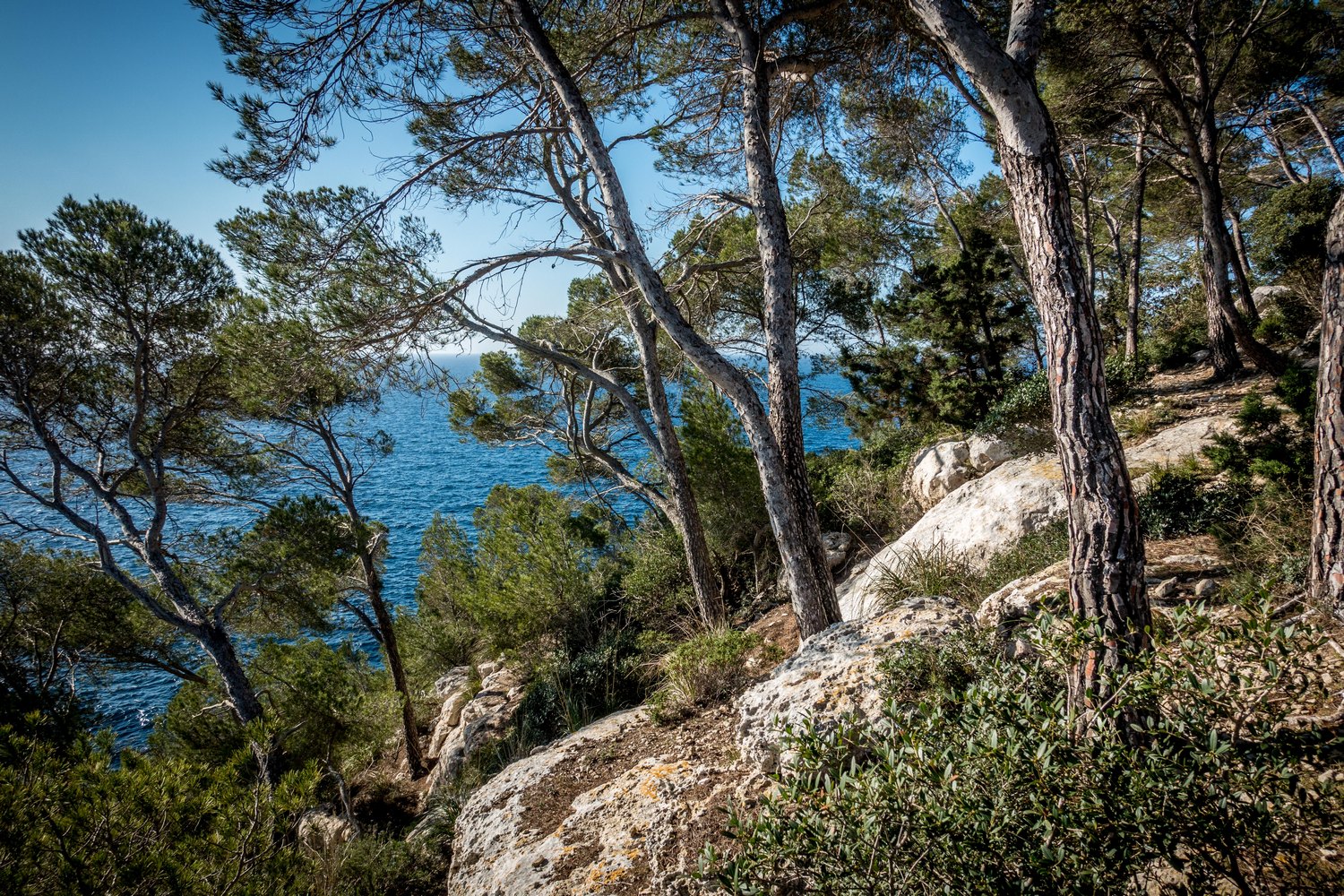
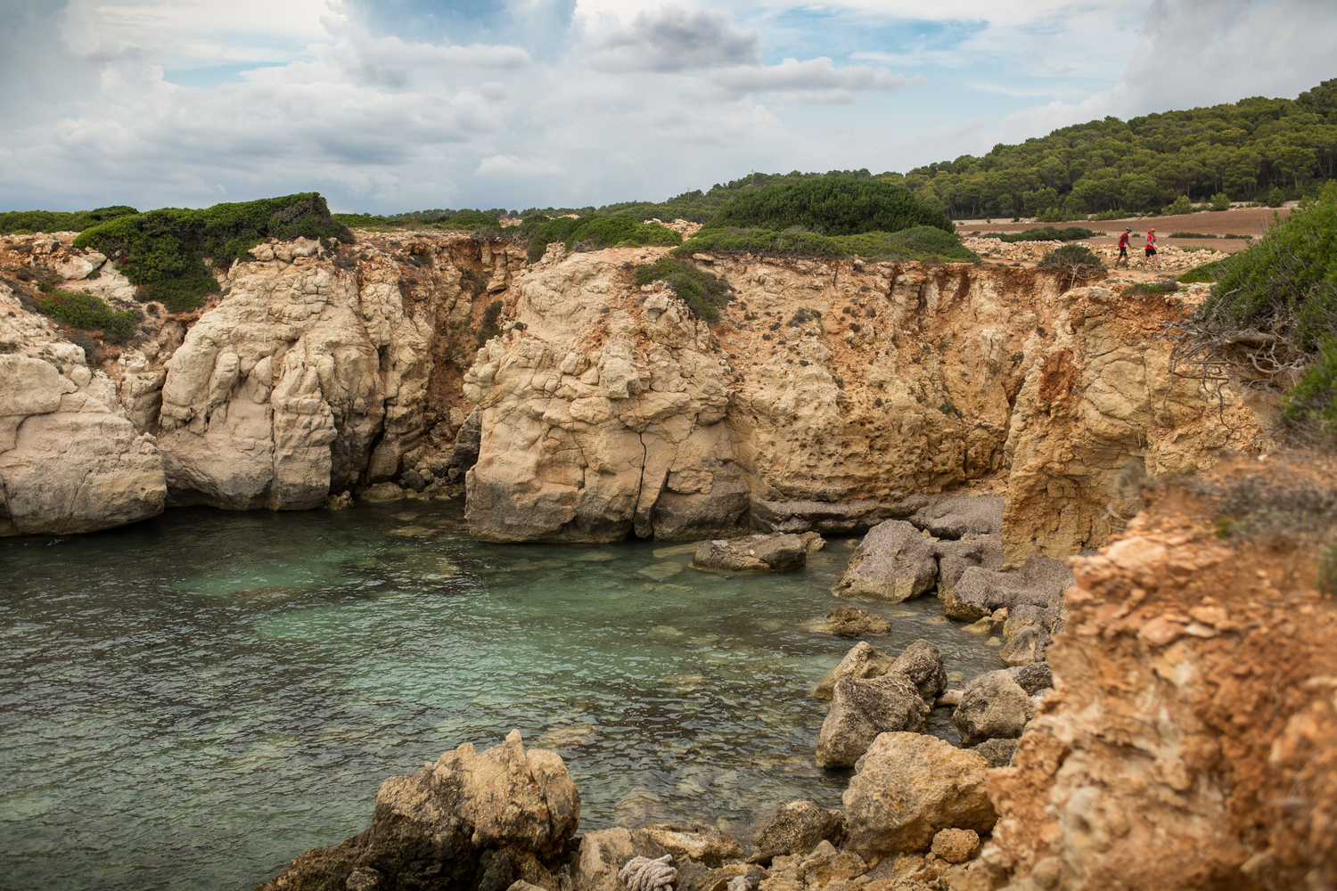
The first half of this stage concentrates most of the elevation gain of the whole southern section of Camí de Cavalls 360º. It is due to the large number of ravines that lead to its southern coast from the inland, cutting the relief as they go. The humidity that they concentrate –some of them go down with water for a good part of the year– making them a kind of green arteries for Menorca.
Precisely the most important of all is the Barranc d’Algendar, which flows into the beach of Cala Galdana, the starting point of the day.
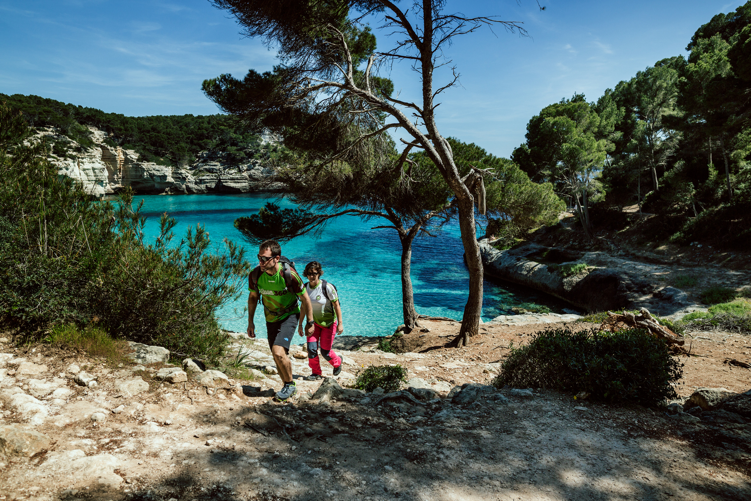
From Cala Galdana to Cala Mitjana
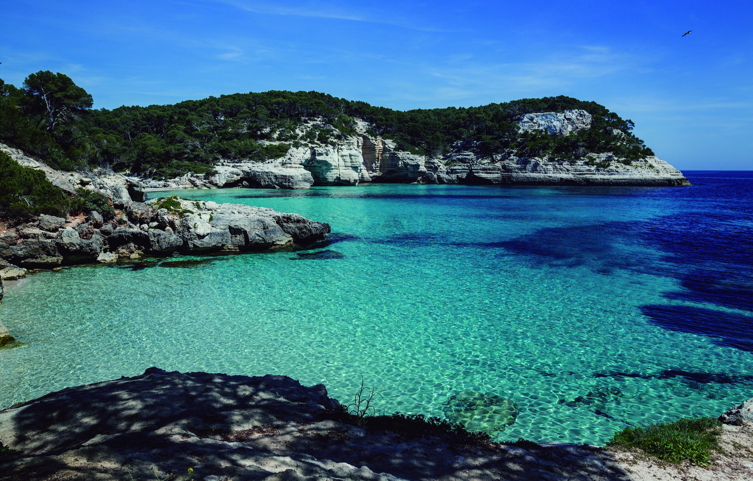
As soon as you start walking, still within the urbanized area, you have to tackle the first steep climb of the day. The Sa Punta viewpoint offers a magnificent panoramic view of Cala Galdana, which is one of the most spectacular coves on the island despite its level of urbanization and the number of tourist services it has.
The path crosses a forest and immediately you can see the remains of an old lime kiln and an abandoned marès (a local kind of sandstone) quarry, already in the vicinity of Cala Mitjaneta and Cala Mitjana. You have to go up again. From the back of the cove, the path moves away from the coast for the next eight kilometers approximately.
On the one hand, views of the sea and panoramic views of charming coves such as Trebalúger, Fustam or Escorxada are lost (they can be accessed through the variant of the Coastal Path). On the other hand, however, shade is gained and different and equally interesting ecosystems are discovered.
From Cala Mitjana to Platges de Binigaus
Around Km 5 of the stage, the path reaches the confluence of the Trebalúger and Sa Cova ravines. Shortly after, you have to cross the deep Barranc de sa Torre, before undertaking a final ascent to access the Barranc de Binigaus, which you must follow again to the coast.
Although going up this last ravine for about two kilometers in the opposite direction, you could reach the Cova des Coloms. It is one of the most famous cavities on the island, and is also known as the cathedral due to its size.
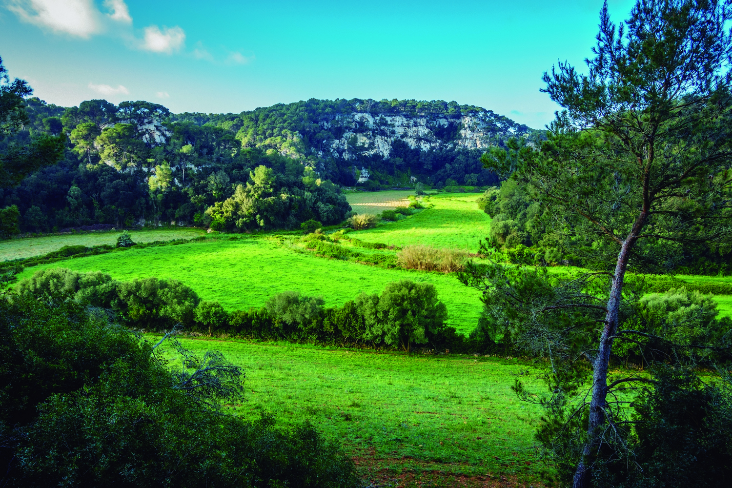
The Platges de Binigaus mark the end of the southern coastal area of Menorca dominated by cliffs and rock, and are at the same time the beginning of a flatter section of the island’s coastline. Its wide expanse of white sand lapped by turquoise blue waters makes it one of the largest unspoiled beaches on the southern coast. The natural stretches from this point will be made up mainly of dune systems, sandbanks and crop fields.
From Platges de Binigaus to Son Bou
The photogenic islet known as Escull de Binicodrell marks the limit between the beaches of Binigaus and Codolar de Binicodrell. It is then followed by Platja de Sant Tomàs, next to which the residential area with the same name has been developed.
Camí de Cavalls 360º runs along the Sant Tomàs promenade for more than a kilometer before coming out into a series of fields and reaching the Na Redona hill. There, you can see the remains of an old defensive tower from the 19th century and a machine gun nest from the Spanish Civil War.
The next Platja de Talis, with its crystal clear waters, is the end of the Platges de Son Bou, the largest sandy area in Menorca with almost four kilometers in length. It has a dune system inhabited by characteristic vegetation and is separated from the tourist resort by the Prat de Son Bou marshes, an important eighty-hectare wetland also known as Albufera de ses Canessies.
From Platja de Talis, the path turns inland to go around Prat de Son Bou and cross the two ravines that feed it: Son Boter first and Es Bec second. Further on, you have to follow the red and white GR signs through the streets of the Son Bou residential area to cross it from end to end.
At the end of the stage, located at the other end of the Son Bou beach, there is an old Paleo-Christian basilica, built in the 5th century.