The first half of this section through the north coast of Menorca finishes crossing the Parc Natural de S’Albufera des Grau and allows to discover some of its main habitats. After going through a series of residential areas, the stages ends near to Fornells, one of the island’s touristic and gastronomic centers.
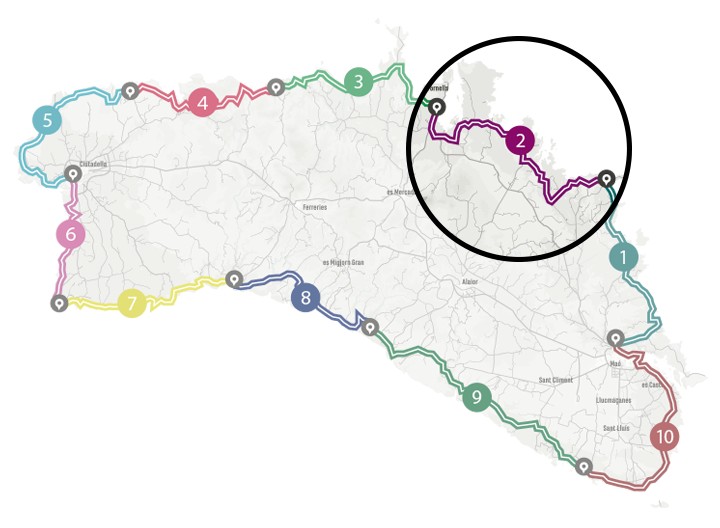
Camí de Cavalls 360º offers a good number of modalities, formulas and formats for participants to enjoy the route with a path adapted to their pace, level and time availability. The Hiking and Trekking 10 stages program is one of the best suited to hikers with some experience and looking for medium difficulty routes.
The 185 kilometers of distance and 2,741 meters of elevation gain are divided into ten feasible days, of about twenty kilometers on average. Participants should only think about enjoying the landscapes and spots through their path. The organization team will take care of the rest: advice on the route and possible variants, logistical issues and even transfers to accommodation when it is not possible to reach them walking.
STAGE #02: FAVÀRITX – SES SALINES DE FORNELLS
STAGE #03: SES SALINES DE FORNELLS – CAMÍ DES ALOCS
STAGE #04: CAMÍ DES ALOCS – CALA MORELL
STAGE #05: CALA MORELL – CIUTADELLA
STAGE #06: CIUTADELLA – CAP D’ARTRUTX
STAGE #07: CAP D’ARTUTX – CALA GALDANA
STAGE #08: CALA GALDANA – SON BOU
STAGE #09: SON BOU – BINIBÈQUER VELL
STAGE #10: BINIBÈQUER VELL – MAÓ
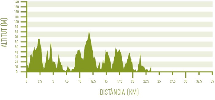
Distance: 23,19 km / Elevation gain: 336 m
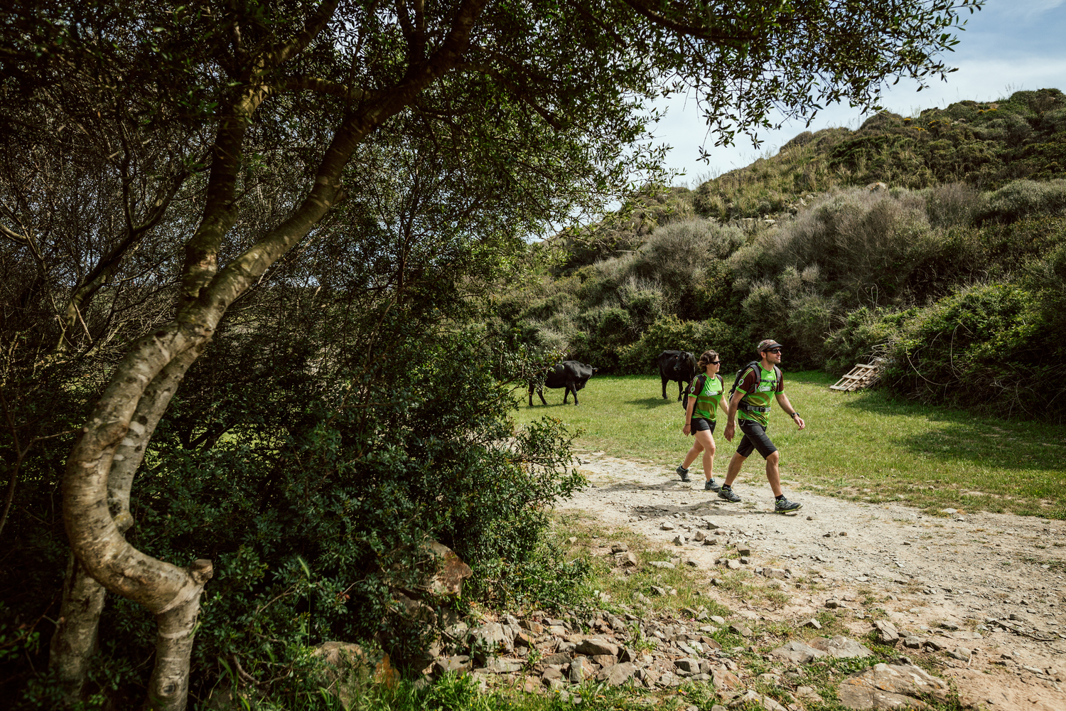
The stage starts from a point near Cap de Favàritx, with a two-kilometer paved section along the road to the lighthouse but in the opposite direction. The trail abruptly veers to the right, through cultivated fields and alongside the old Favàritx military batteries, now out of use.
From the top of a hill, you can enjoy magnificent panoramic views of the entire Addaia area, with Na Macaret in the background and the idyllic Cala Mongofra –which is not in the path of the Camí de Cavalls– in the middle distance.
Parc Natural de S’Albufera des Grau
The route then goes down very decidedly towards Es Pou d’en Caldes, a lonely cove with a pebble beach. This entire zone is part of the area protected by the Parc Natural de S’Albufera des Grau and it is one of the spots with the highest concentration of endemic plant species on the island. You can see samples of the spectacular pink bell-shaped flowers of foxglove (Digitalis minor) and up to five different species of socarrells.
The GR 223 once again moves away from the coast and goes into a just over two kilometers section full of slopes that overcomes several arroyos and cultivated fields. Finally, it comes out onto a wide path, the historic Camí d’Addaia, which you have to take to the right.
Along the path on the left, the curious red sandstone formations of Es Capell de Ferro rise. This type of rock, which is known as sharpening stone in Menorca, takes some capricious shapes due to erosion.
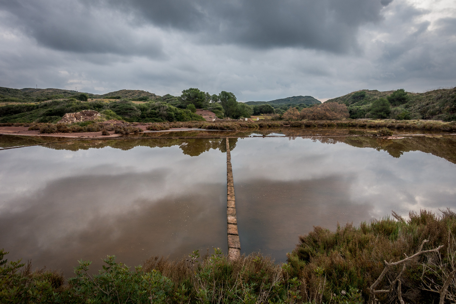
At the end of the path, a gate gives access to the Salines de Mongofra area. This high ecological value salt flat ecosystem is one of the most interesting birdwatching spots on the island. Especially in winter, due to the large number of aquatic birds that frequent its reddish-looking landscapes.
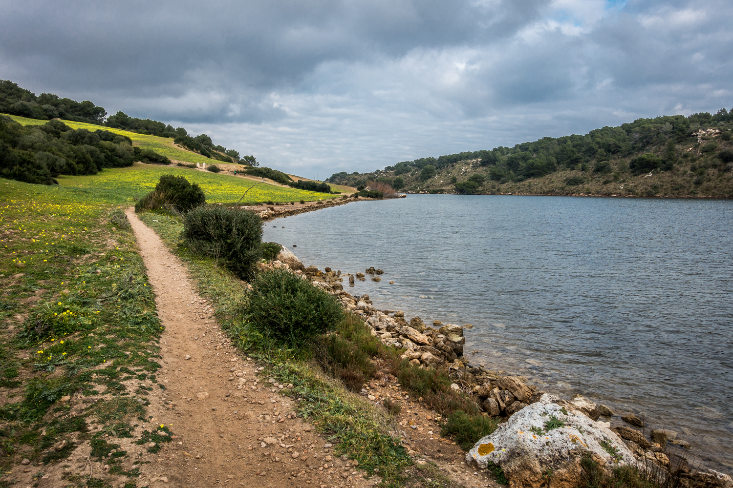
The path loses all elevation gain through the salt flat environment and it becomes the aquatic ecosystem called Port d’Addaia. This long natural bay with calm and shallow waters is one of the few Mediterranean habitats for little Neptune grass (Cymodocea nodosa), a plant related to Posidonia oceanica (Neptune grass) and also growing in underwater meadows.
From Port d’Addaia to Prat de Son Saura
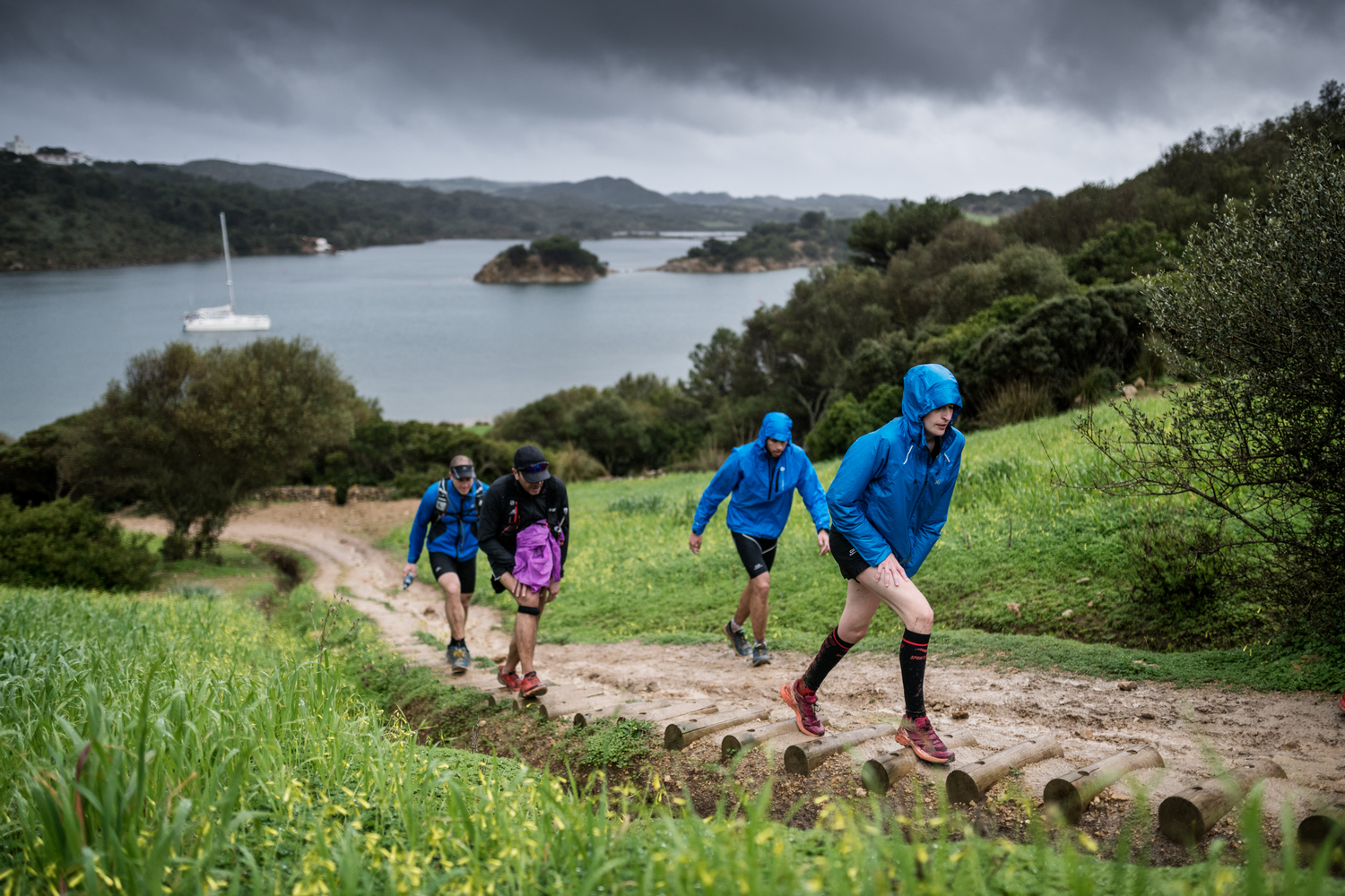
A steep 200-meter stretch leaves the natural park and leads to Addaia residential area, which extends from the bay entrance and has a small marina. The next 3.5 kilometers connect the residential areas of Addaia, Coves Noves and Arenal d’en Castell and goes on the paved ground of streets and roads.
The elevation gain is definitely smoothed out until the end of the stage. From the charming semi-urban beach of Arenal d’en Castell, the path follows approximately one kilometer of rocky coastline to the next residential area, Son Parc.
Its wide white sand beach, known as Arenal de Son Saura, houses a recovered dune system, with dunes up to ten meters high. A walkway allows you to visit it without damaging the environment.
Then, you will be surprised by an interesting habitat that can only be seen through a dense vegetation of rush and reed. These are the wetlands known as Prat de Son Saura. Many species of birds can be seen, both in winter and spring, which is the nesting season.
From Prat de Son Saura to Ses Salines de Fornells
Crossing the Mola de Fornells isthmus, the route enters the Albufera des Comte estate. It is a wooded area of holm oaks and pines, where species such as heather and arbutus also abound. Its 1,200 hectares make this estate the largest one in all of Menorca. It is a comfortable and shaded stretch of trail where, in autumn, mushrooms proliferate.
When leaving the forest, the path goes by the archaeological site of the early Christian basilica of Es Cap des Port. It is dated between the V and VII centuries and is open to visits.
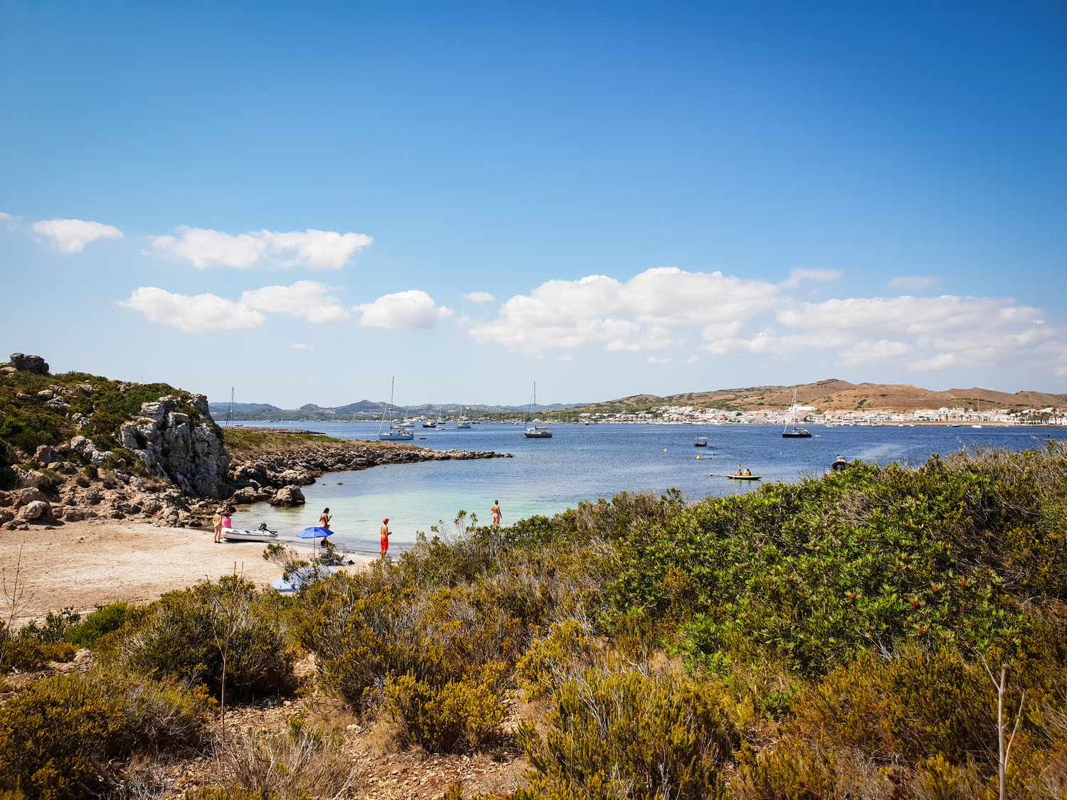
Another small section of forest comes out onto the road, which must be followed during the last 2.3 kilometers of the stage until reaching Ses Salines residential area, open onto the large bay of Fornells.
Strictly speaking, the stage ends here. Nonetheless, it is worth extending it 1.4 more kilometers to reach the fishing village of Fornells. The promenade, on the road by the sea, goes through the main restaurant area of this gastronomically renowned town, before crossing its square and ending by the defense tower.