Anyone exploring northern Menorca on Camí de Cavalls 360º soon discovers a very different side of the island from the one usually seen on postcards. Here, the spotlight falls not so much on beaches as on geology, the elements, dune systems, traditional llocs (Menorcan farm estates), wetlands and a landscape that reveals the distinctive relationship between nature and human activity.
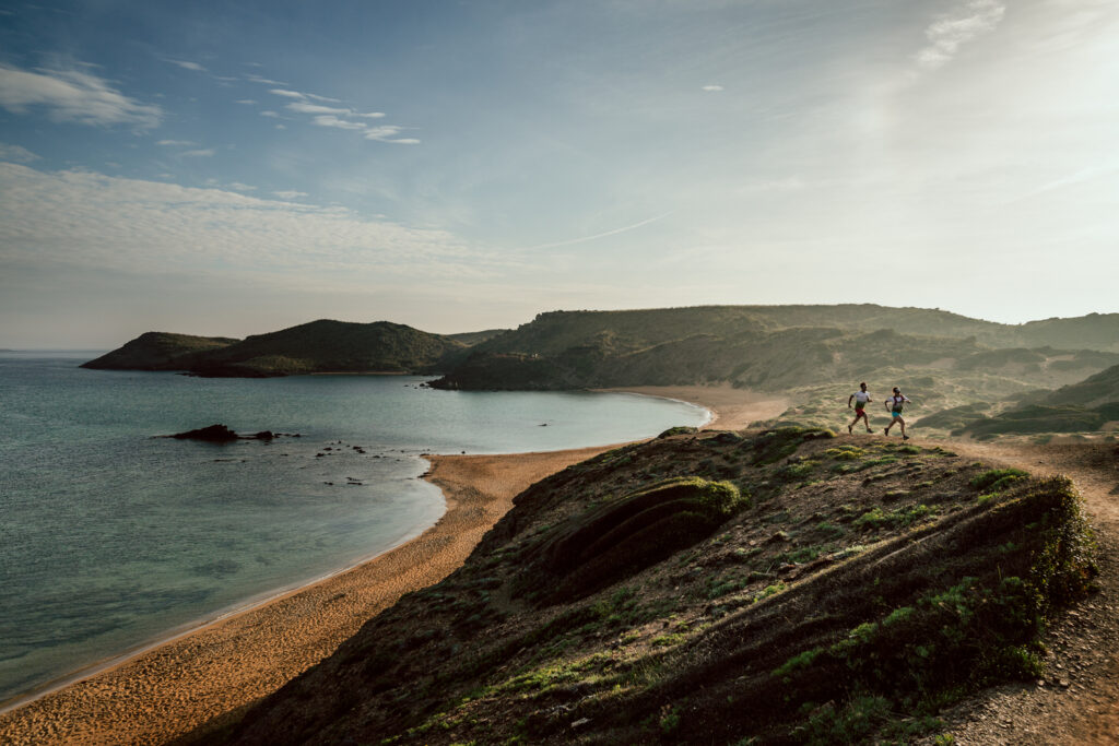
The northern half of the island is home to some of Menorca’s most diverse landscapes. Ancient geological formations, constant exposure to the Tramuntana wind and centuries of human activity centred on livestock farming and the careful use of natural resources have shaped a remarkably varied landscape that is best appreciated from the Camí de Cavalls.
For participants on Camí de Cavalls 360º, exploring the 180º North route becomes a way to discover and understand the island.
Why is the north so different?
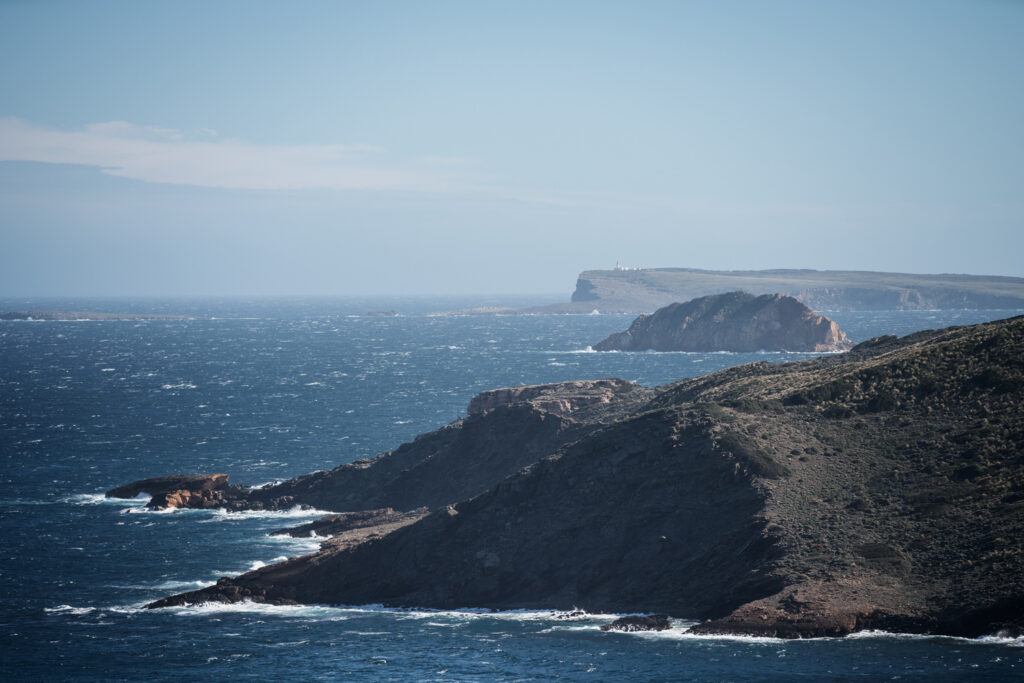
Northern Menorca presents a striking contrast with the south. While the southern half of the island is dominated by more uniform limestone formations, the north displays an extraordinary geological diversity thanks to the presence of much older rocks. The result is an ever-changing landscape of cliffs, rolling hills, streams, small valleys and an impressive range of colours in both the soil and the beaches.
The Tramuntana wind also plays a defining role. It shapes the vegetation, sculpts the dunes, influences navigation and forms part of the experience of everyone travelling these sections of Camí de Cavalls 360º. The wind is more than just a weather phenomenon—it is one of the great sculptors of the landscape and one of the forces that gives northern Menorca its distinctive character.
The North’s Hidden Gems
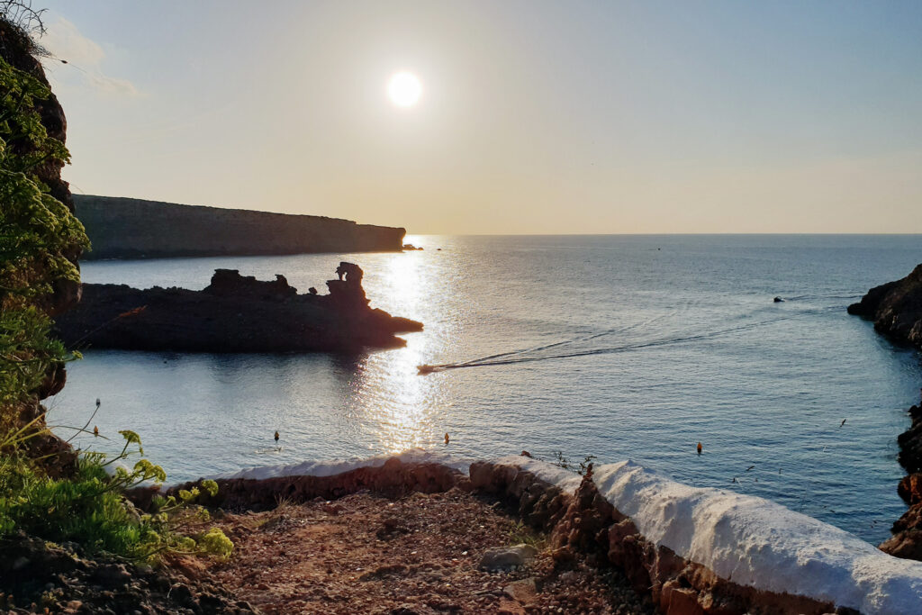
Favàritx: geology at the water’s edge
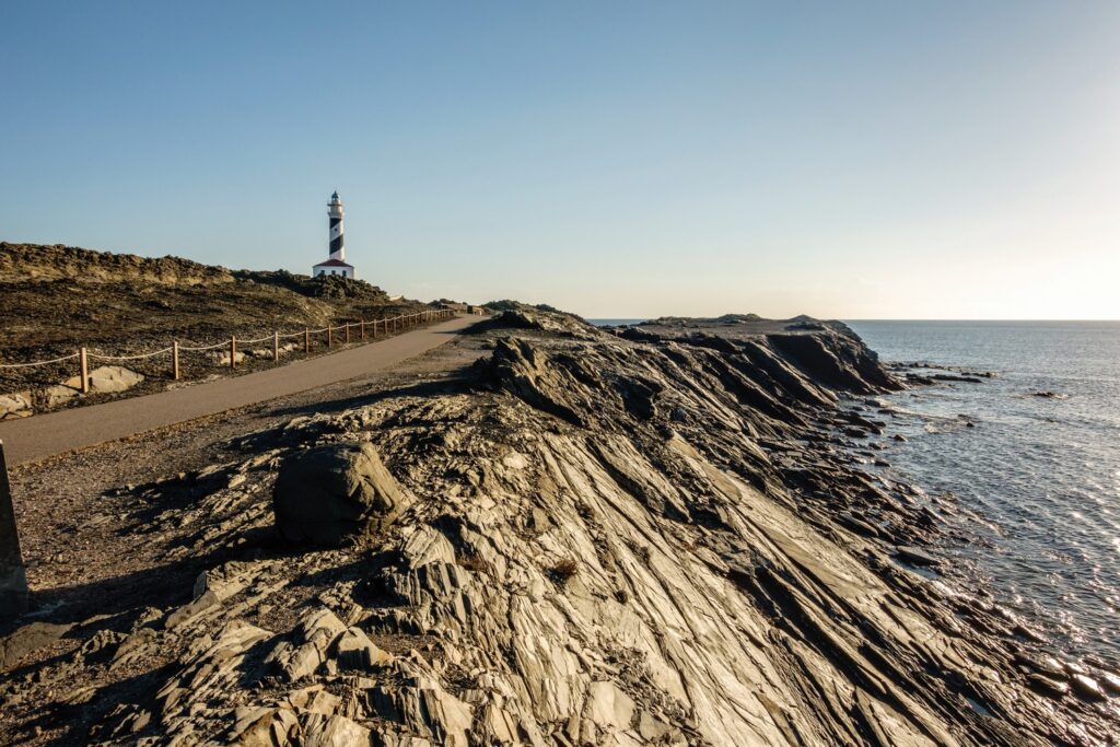
Few places capture the character of northern Menorca as perfectly as Cap de Favàritx. Camí de Cavalls 360º includes the option of taking a short detour to the lighthouse, one of the recommended optional excursions along the route. The landscape here is dominated by dark slate rocks and gently rolling terrain, creating a striking contrast with the white-sand coves more commonly associated with the south of the island. The lighthouse, inaugurated at the beginning of the twentieth century, stands in one of the areas most exposed to the powerful Tramuntana storms.
Yet Favàritx is about far more than its lighthouse. The entire area forms part of S’Albufera des Grau Natural Park, a protected landscape that is essential to understanding the environmental values that led to Menorca being declared a UNESCO Biosphere Reserve.
For hikers and mountain bikers alike, it is also one of the best places to appreciate how geology shapes the landscape. Dark rocks, low-growing vegetation and the relative absence of trees create an atmosphere unlike anywhere else on the island.
S’Albufera des Grau and the island’s wetlands
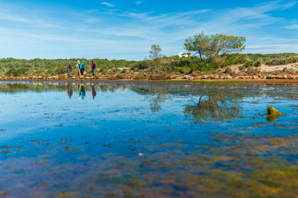
At the eastern end of northern Menorca lies S’Albufera des Grau Natural Park, one of the island’s most important ecological areas. Its lagoon, coastal wetlands, dune systems and surrounding farmland create a rich mosaic of habitats that supports an exceptional diversity of birdlife. Many of Menorca’s environmental protection designations are closely linked to these ecosystems.
For participants on Camí de Cavalls 360º, the stages around Es Grau reveal a different side of Menorca—one that is less defined by the coastline itself and more by the fascinating interaction between land and water.
The best way to explore this area is by staying on the marked trails at all times and avoiding sensitive habitats, particularly during the breeding season for wildlife.
Cavalleria: a headland shaped by wind and history
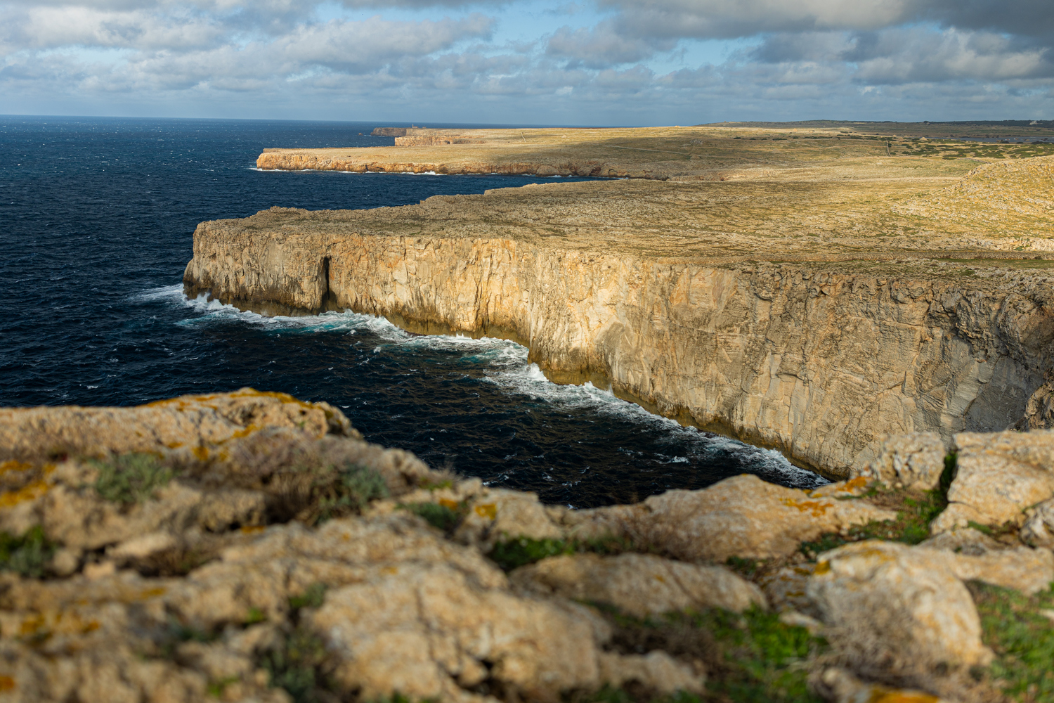
Cap de Cavalleria is another of northern Menorca’s defining landmarks. Geographically, it is one of the island’s most prominent headlands, reaching out into the open Mediterranean. Throughout history, it has played an important role in maritime surveillance and navigation, explaining the presence of both the lighthouse and the Roman harbour and settlement of Sanitja (the ancient city of Sanisera).
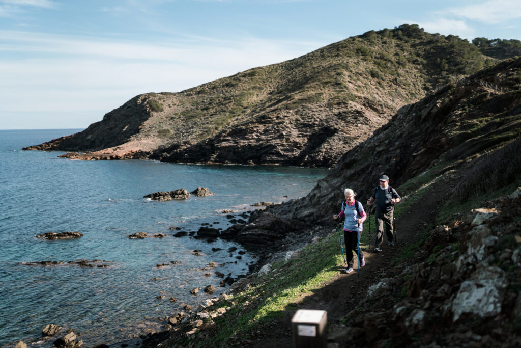
For hikers, the appeal of this area extends far beyond its spectacular views. The surrounding landscape offers an opportunity to observe erosion processes, remarkable geological outcrops, secluded coves and plant communities that have adapted to some of the island’s harshest environmental conditions.
It is also an excellent example of how Camí de Cavalls links outstanding natural landscapes with cultural heritage sites connected to the defence and historical monitoring of Menorca’s coastline.
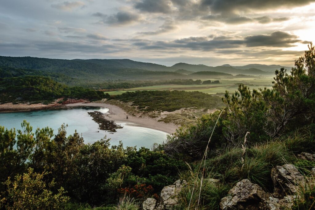
Binimel·là and Pregonda: where geology becomes landscape
Among the most iconic places in northern Menorca—and right on the route of Camí de Cavalls 360º—are the areas around Binimel·là and Pregonda. Here, geology once again takes centre stage. Reddish rock formations, striking outcrops and the shape of the coastline reveal geological processes that have been shaping this landscape for millions of years.
From a hiking perspective, this is an area where it’s worth allowing yourself plenty of time. Not because the terrain is especially technical, but because this landscape deserves to be explored carefully. The sculpted landforms, the small offshore islets and the close relationship between the island’s geology and vegetation make this one of the most fascinating sections of the entire route.
The remoteness of Es Alocs
The section between Cala Barril and Es Alocs is often regarded as one of the most demanding stretches of the northern Camí de Cavalls. The combination of uneven terrain, constant exposure to the elements and its remote location calls for careful planning. Yet it is precisely these characteristics that have preserved its sense of wilderness, something increasingly rare to find elsewhere on the island.
This is a landscape of short ravines, rocky slopes and hardy vegetation adapted to challenging conditions. Human presence is minimal, allowing visitors to appreciate just how much of Menorca’s northern coastline remains largely untouched. For many hikers, this is one of the sections that best captures the essence of Camí de Cavalls 360º. For mountain bikers, however, it is widely regarded as one of the most technically demanding stretches of the entire route.
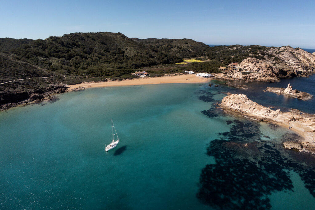
The agricultural and woodland mosaic of La Vall and Algaiarens
As the route approaches Algaiarens, the landscape changes once again. La Vall is one of the places where the relationship between nature conservation and traditional farming can best be appreciated. Fields, woodlands, dunes, small wetlands and coastal habitats all coexist within a remarkably varied landscape.
This area is home to significant ecological values and enjoys several environmental protection designations, particularly for its wildlife and coastal habitats. For hikers, it offers an excellent opportunity to understand that Menorca’s landscape is not shaped solely by natural processes. It is also the result of centuries of farming, dry-stone wall construction, careful management of natural resources and the preservation of the island’s traditional llocs (farm estates).
Among La Vall’s highlights are the beaches of Es Tancats and Es Bot, two beautiful stretches of pale sand washed by crystal-clear waters and framed by pine forests, dunes and rocky headlands. Es Tancats offers the broad, open feel of a spacious bay, while Es Bot, tucked away at its far end, has a wilder atmosphere, with vegetation reaching almost to the shore and the Torrent de la Vall flowing into the sea nearby.
Cala Morell: where heritage meets the coastline
Most visitors associate Cala Morell with its small coastal settlement, but its greatest heritage value lies just beyond it. The surrounding area is home to a remarkable prehistoric necropolis carved into the rock, together with the remains of a settlement occupying a small peninsula overlooking the sea. Together, they form one of Menorca’s most important archaeological sites and offer valuable insight into how the island was inhabited long before the modern era.
From a geological perspective, Cala Morell is equally remarkable. Within just a few metres, visitors can observe several very different rock formations: reddish Miocene conglomerates, grey Jurassic dolomites and marés, the sandstone traditionally used in Menorcan architecture. A geological fault and centuries of marine erosion have exposed the contact between these materials, creating a natural cross-section that reveals sedimentary processes, tectonic activity and ancient changes in sea level.
Arriving at Cala Morell along Camí de Cavalls 360º offers a particularly rewarding combination of cultural heritage, coastal geology and magnificent seascapes. It is one of the best places along the route for anyone wishing to complement the sporting experience with a deeper understanding of Menorca’s history and landscape.
A different way to understand the island
Northern Menorca is not defined by any single landmark or attraction. Its true richness lies in the combination of geology, history, biodiversity, traditional farming and the culture of the trail. Exploring it on foot or by mountain bike offers a deeper understanding of why Camí de Cavalls 360º is so much more than a sporting challenge. The route follows a historic path that links lighthouses, wetlands, traditional llocs, protected natural areas and countless traces of the island’s past.
That is why so many participants remember these northern stages above all the others. It’s not just because of the kilometres they’ve covered, but because this part of the route offers one of the most complete and rewarding ways to discover and understand Menorca.