The first twenty kilometers of Camí de Cavalls 360º include great attractions, such as the Parc Natural de S’Albufera des Grau, the most important protected area on the island. In addition, you can also see examples of native vegetation, defensive towers and lonely unespoiled coves.
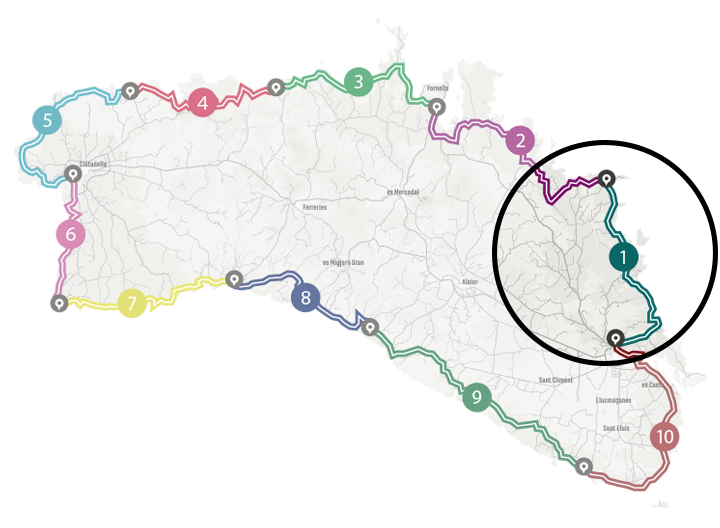
Camí de Cavalls 360º offers a good number of modalities, formulas and formats for participants to enjoy the route with a path adapted to their pace, level and time availability. The Hiking and Trekking 10 stages program is one of the best suited to hikers with some experience and looking for medium difficulty routes.
The 185 kilometers of distance and 2,741 meters of elevation gain are divided into ten feasible days, of about twenty kilometers on average. Participants should only think about enjoying the landscapes and spots through their path. The organization team will take care of the rest: advice on the route and possible variants, logistical issues and even transfers to accommodation when it is not possible to reach them walking.
STAGE #02: FAVÀRITX – SES SALINES DE FORNELLS
STAGE #03: SES SALINES DE FORNELLS – CAMÍ DES ALOCS
STAGE #04: CAMÍ DES ALOCS – CALA MORELL
STAGE #05: CALA MORELL – CIUTADELLA
STAGE #06: CIUTADELLA – CAP D’ARTRUTX
STAGE #07: CAP D’ARTUTX – CALA GALDANA
STAGE #08: CALA GALDANA – SON BOU
STAGE #09: SON BOU – BINIBÈQUER VELL
STAGE #10: BINIBÈQUER VELL – MAÓ
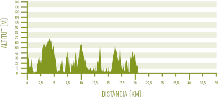
Distance: 20,37 km / Elevation gain: 403 m
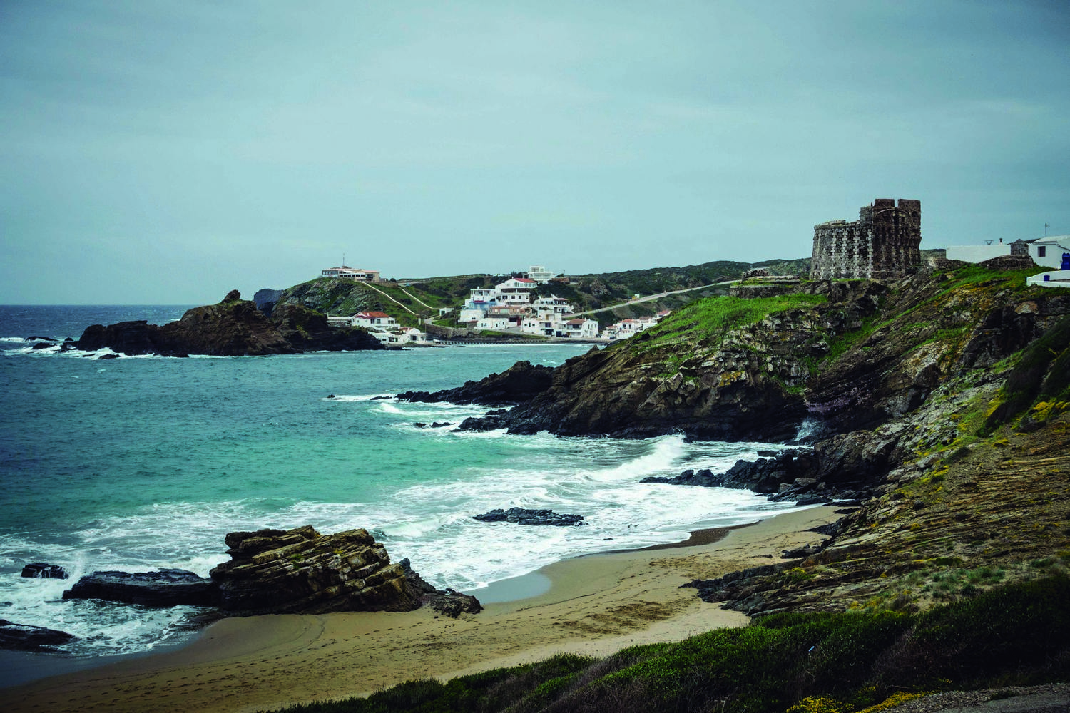
The Camí de Cavalls 360º starting point is the ancient city of Maó. Historic cobbled streets and squares connect monumental buildings such as the town hall, the church of Santa Maria or the Claustre del Carme market. The offer of restaurants and the charming shop windows outside the tourist stereotype complete the picture.
The old part of the town extends over a line of cliffs that rise above the waters of Port de Maó. With its six kilometers length, it is the largest natural port in the Mediterranean and the reference point to start the route.
From Maó to Sa Mesquida
Six kilometers of paved road lead from Port de Maó to the small town of Sa Mesquida. The pavement reaches the parking lot of the wide beach of Cala Mesquida. It has transparent waters and white sand, and is delimited on each side by an 18th century English defense tower and a rock almost 70 meters high, called Es Pa Gros.
From Sa Mesquida to Es Grau
A constant up and down path follows the coast from Cala Mesquida and allows you to discover the first stretches of marinas and rocky coves that define a good part of the Menorcan coast so well. This section is especially appreciated during the spring, when the flowers of heather, myrtle and sage-leaved rock-rose cover the landscape in white. At the same time, it is possible to admire some communities of socarrells, a type of endemic shrub that adopts a characteristic spiny cushion shape.
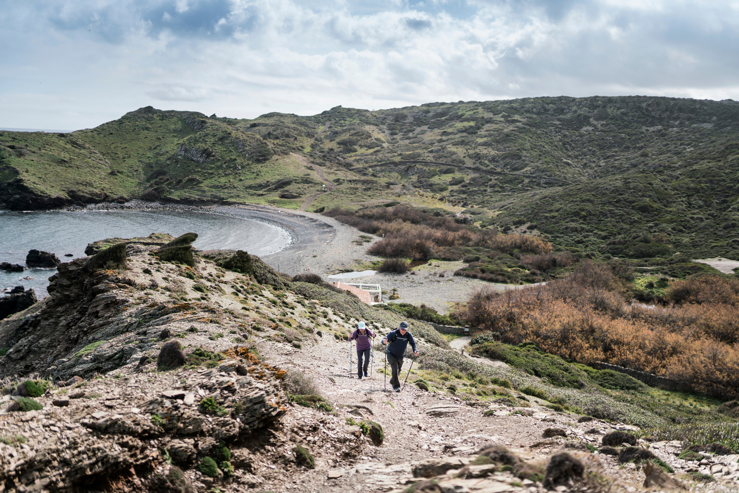
Later, in Binillautí, the first example of macar appears. This is the name by which the pebble beaches or coves are known on the island. The wind, the pounding of the waves and the salt have shaped these coasts for millennia.
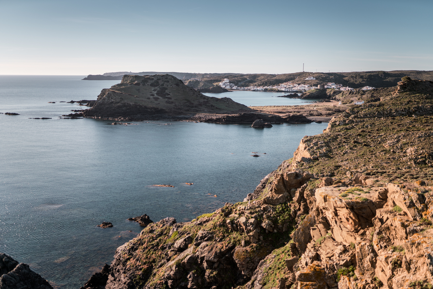
At the Caleta de Binillautí, the route momentarily turns its back to the sea and goes into the territory of the Parc Natural de S’Albufera des Grau. The first section within the protected area, however, immediately links up with the access road to the town of Es Grau.
This charming town has a long tradition as a summer destination for the inhabitants of Maó, who began to build their second residences as early as the late 19th century. Today, it is a fairly active tourist center, with a remarkable social life, while maintaining its original relaxed and sailor character.
From S’Albufera des Grau to Favàritx
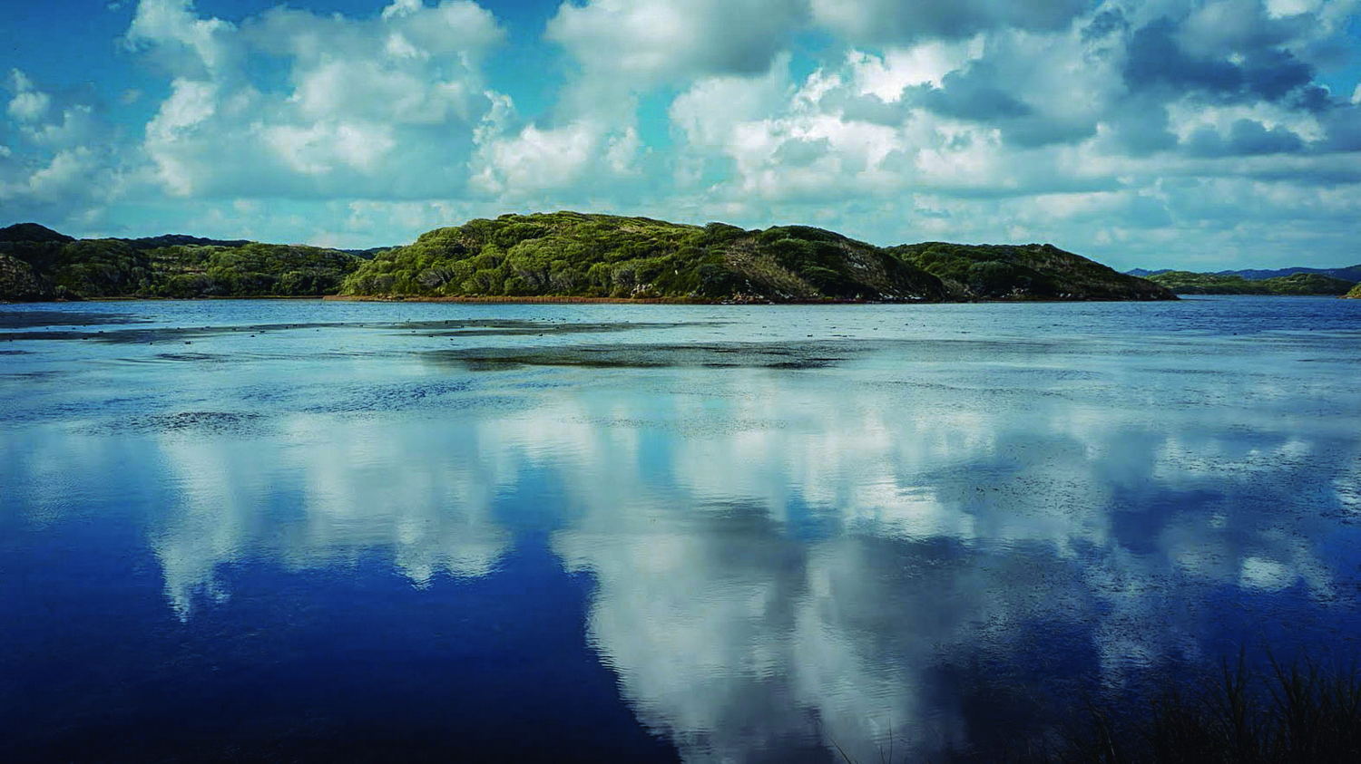
About 300 meters before reaching the town of Es Grau, a detour to the left enters the S’Albufera area. This is the core area of the Biosphere Reserve and habitat of many species of birds in their migratory way between Africa and Europe. There is the chance of approaching one of the viewpoints of the Parc Natural and watch some fauna specimens by the lagoon’s water.
The path goes on flat up to the extensive sandy area of the shell-shaped Platja des Grau. As you cross this beach, the track narrows. Then it gains elevation to the north and the lonely Cala des Tamarells. It is worth enjoying the panoramic view with the Illa d’en Colom in front and the Torre de Rambla on the north side. It is another defensive round building built by the British during their domination of the island in the 18th century.
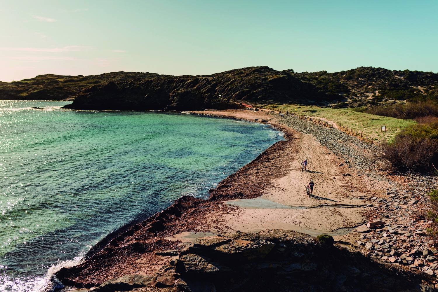
Along the following kilometers, the route alternately goes into inland sections and virgin coves such as Sa Torreta, En Cavaller or Morella Nou. When the end of the stage approaches, you can see Cala Tortuga and Cala Presili. They are two very popular beaches for bathing, thanks to their fine white sand. They also provide the best views of the Far de Favàritx.
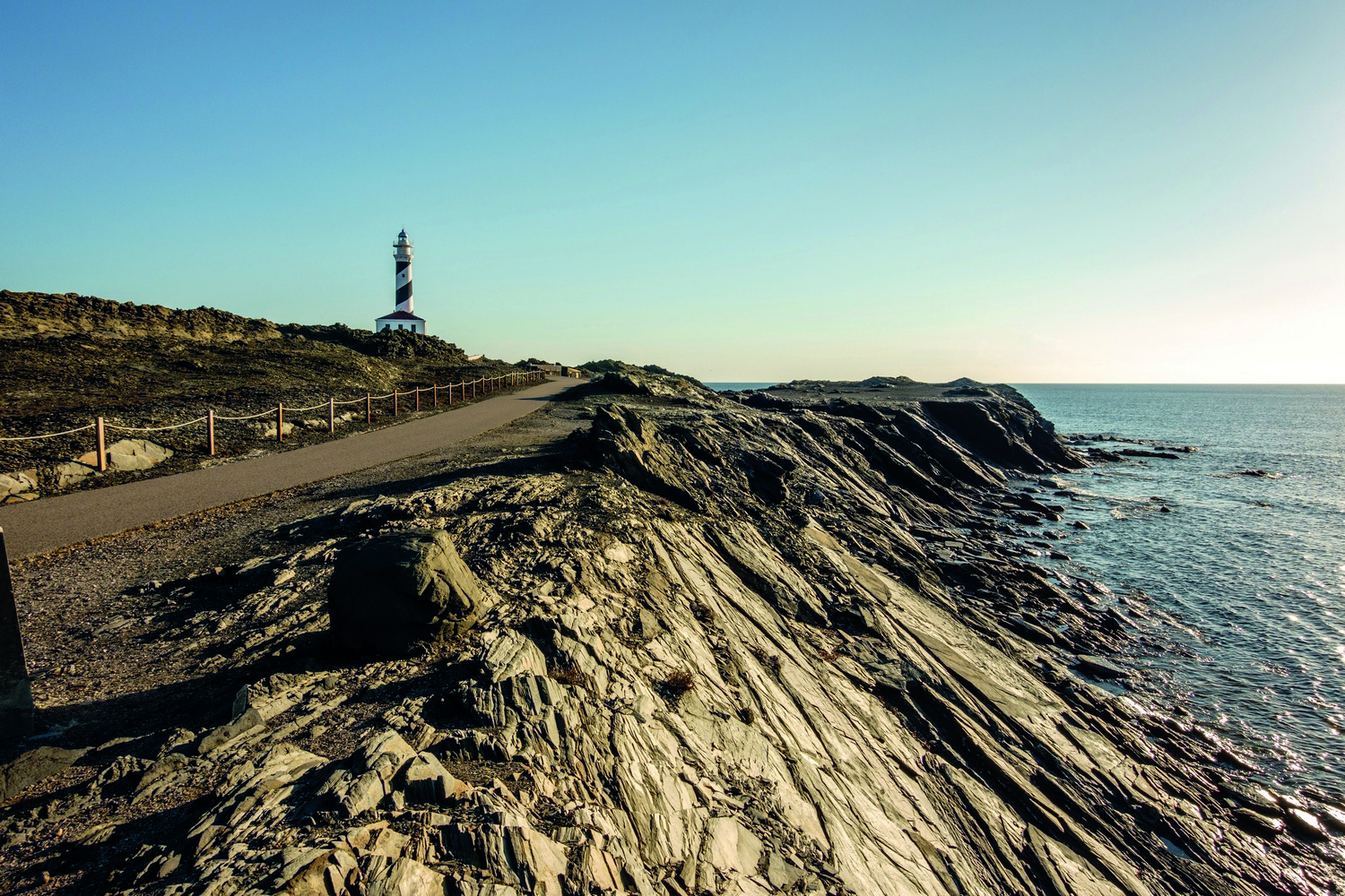
Far de Favàritx
This section of Camí de Cavalls 360º ends at the access road to the lighthouse. To get there, you just have to follow it for about 850 meters. The prize for the extra effort is a landscape dominated by black rocks, which gives it a lunar appearance.
The environment also has a photogenic temporary pond known as Cós del Síndic. It gets flooded by storms and is the habitat of wading birds and rare aquatic plants.
In the background, Cap de Favàritx and its lighthouse mark the northeast tip of Menorca. It was inaugurated in 1922 to complete the lighting of the north coast of the island as a complement to the Cavalleria and Punta Nati lighthouses. Its 28 meter high tower, painted white with a helical black band, contrasts with the natural harshness of its surroundings.