A desolate landscape battered by the weather is the scene of the route’s section that goes from the north to the west of Menorca. Stone and cliffs dominate, and vegetation is sparse. Towards the end, the emblematic Pont d’en Gil leads to the residential areas announcing the arrival in Ciutadella.
Camí de Cavalls 360º offers a good number of modalities, formulas and formats for participants to enjoy the route with a path adapted to their pace, level and time availability. The Hiking and Trekking 10 stages program is one of the best suited to hikers with some experience and looking for medium difficulty routes.
The 185 kilometers of distance and 2,741 meters of elevation gain are divided into ten feasible days of about twenty kilometers on average. Participants should only think about enjoying the landscapes and spots through their path. The organization team will take care of the rest: advice on the route and possible variants, logistical issues and even transfers to accommodation when it is not possible to reach them walking.
STAGE #02: FAVÀRITX – SES SALINES DE FORNELLS
STAGE #03: SES SALINES DE FORNELLS – CAMÍ DES ALOCS
STAGE #04: CAMÍ DES ALOCS – CALA MORELL
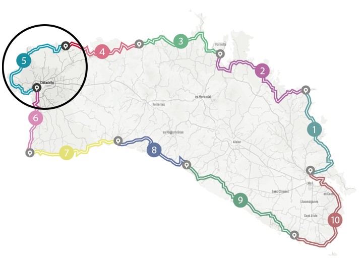
STAGE #05: CALA MORELL – CIUTADELLA
STAGE #06: CIUTADELLA – CAP D’ARTRUTX
STAGE #07: CAP D’ARTUTX – CALA GALDANA
STAGE #08: CALA GALDANA – SON BOU
STAGE #09: SON BOU – BINIBÈQUER VELL
STAGE #10: BINIBÈQUER VELL – MAÓ
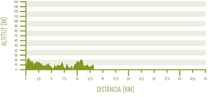
Distance: 18,9 km / Elevation gain: 304 m
Cala Morell and its orderly residential area, with its archaeological remains of the Talayotic civilization, its bathing spots and the boats that frequent it, will be the only example of civilization in a few kilometers. There are no other inhabited places until the residential areas close to Ciutadella. The environment is rugged and wild.
From Cala Morell to Punta Nati
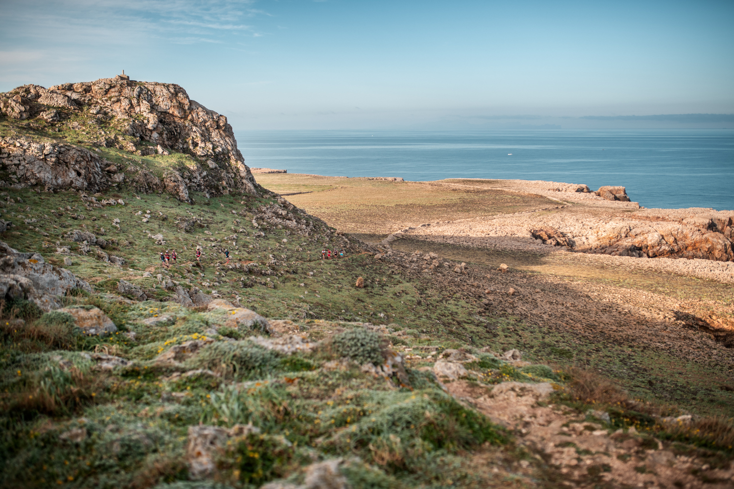
After leaving Cala Morell behind, you have to go along the edge of Cul de sa Ferrada cliffs, which allow you to enjoy good views. The path then moves away from the coast and the landscape progressively forgets about the vegetation: the trees are only a memory of the past and the bushes are increasingly scarce. They are replaced by herbaceous plants: socarrells, Balearic smilax, chamomile and caper will be the most exuberant vegetation between the sharp stone and the bare rock.
The wind and the sea have shaped this harsh landscape. Good news for hikers is that elevation gain is minimal, despite the continuous ups and downs to cross streams. In Son Morell, the path goes by a well-preserved dry stone hut. It is one of many examples of how the island’s inhabitants have tried to profit from the land, no matter how poor.
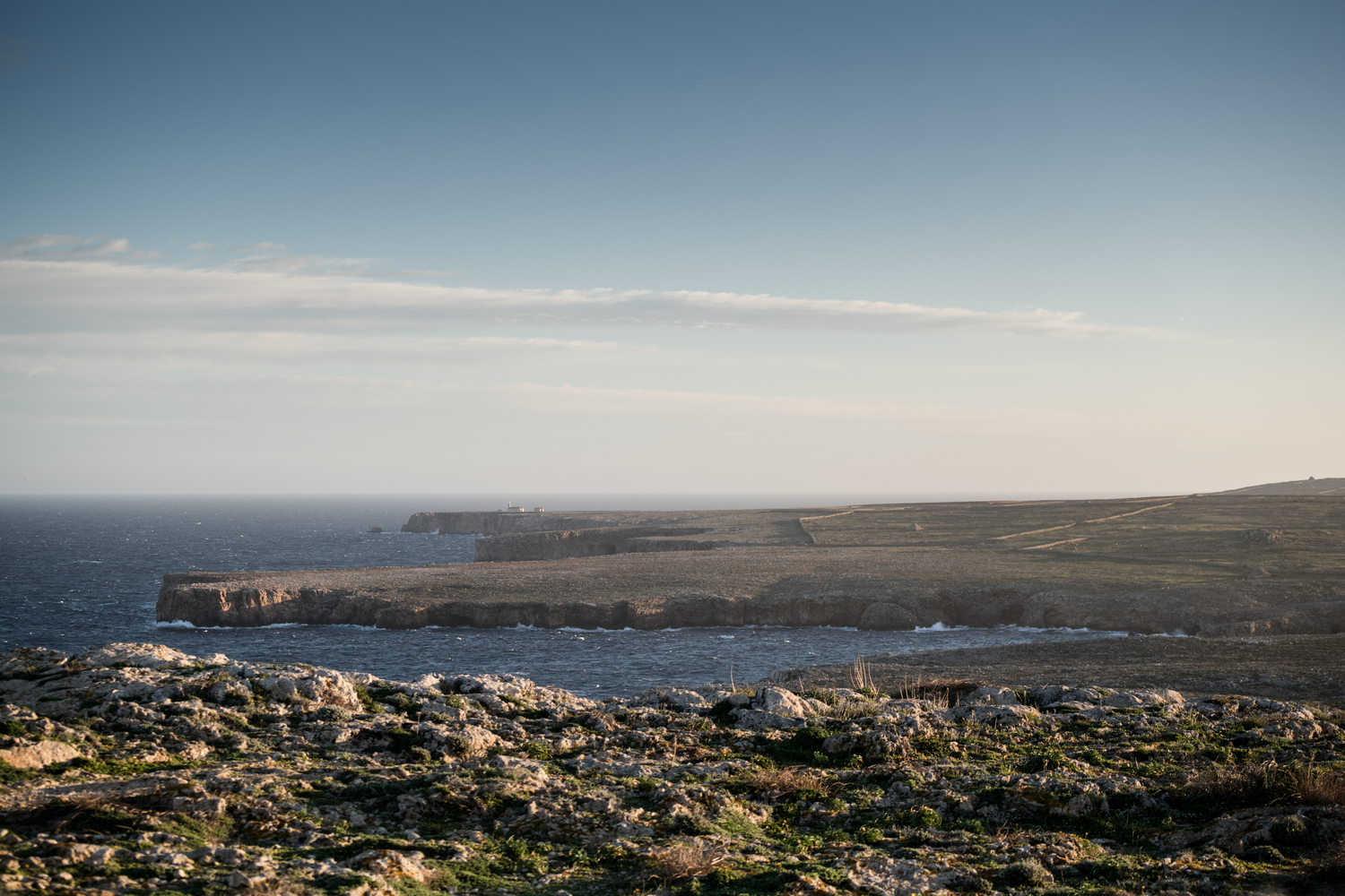
After Punta des Llosar and in the vicinity of Punta Nati, at the height of the Codolar de sa Torre Nova, a cross is erected in memory of the shipwreck of the Général Chanzy steamship in 1910. At dawn on February 10 and in the middle of the storm, the ship sailing from Marseille to Algiers was dragged to the cliffs: there was only one survivor among the 87 crew and 70 passengers on board. The accident caused a huge commotion, with international repercussions, and resulted in the construction of the neighboring Farola de Punta Nati lighthouse, which started working in 1913.
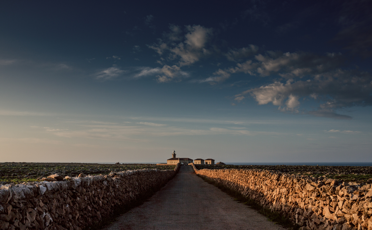
From Punta Nati to Pont d’en Gil
The lighthouse itself is about 600 meters from the GR, which crosses its access road and still goes through the same arid and harsh rocky area. This monotony is only interrupted where the panorama prevails, as in Morro de sa Falconera, first, and Cala des Corbetar, later.
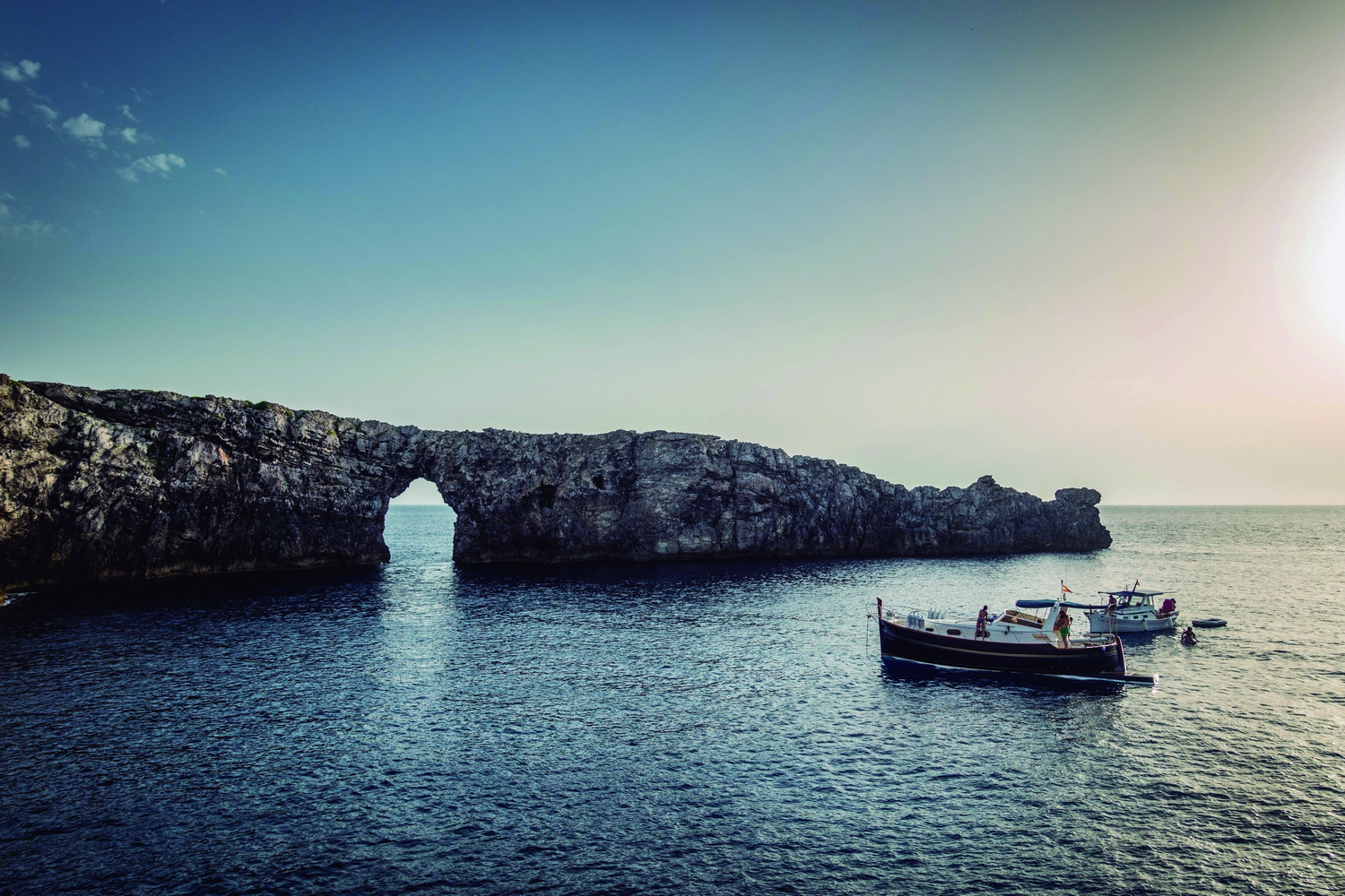
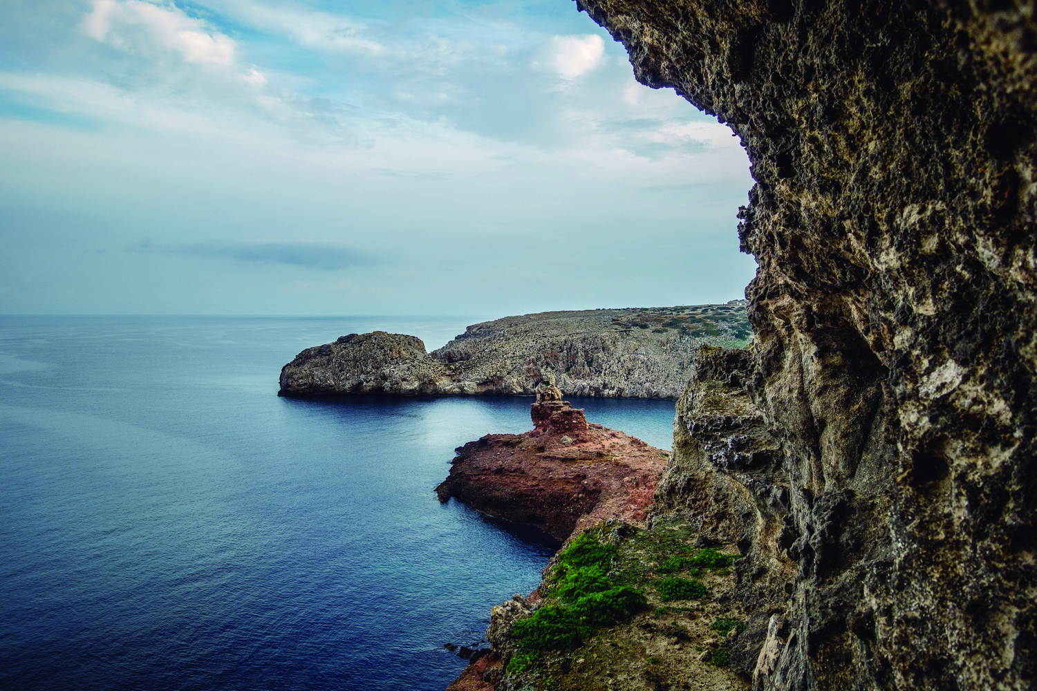
From this point you can admire the spectacular Pont d’en Gil, where marine erosion has carved a huge opening in the cliff face, forming a photogenic natural bridge in the rock. It is one of the most emblematic settings and an iconic image of Menorca.
In the surroundings, a cavity about 300 meters deep, known as Cova de s’Alemanya, also stands out.
From Pont d’en Gil to Ciutadella
Then, Camí de Cavalls 360º returns to the asphalt and to civilization, for the five remain kilometers until reaching Ciutadella. First, it goes through the residential areas of Calespiques and Cala en Blanes, both linked in a continuum of streets, second homes, hotels and holiday apartments located around small coves with transparent waters, perfectly adapted for swimming: successively there is the cove of Calespiques, Cala en Forcat, Cala en Brut and Cala en Blanes.
You have to go around this last small and elongated cove to access a pleasant promenade, frequented by tourists and locals on foot and by bicycle who watch the sunset during the summer months. The walk leads to Sa Farola, a small lighthouse located at the end of the natural port of Ciutadella, which is one of the great attractions of the city.
The port area concentrates some of the most admired restaurants on the island. Its terraces allow you to taste mainly tapas and seafood recipes. Many Camí de Cavalls 360º participants take the chance to enjoy a day of rest in Ciutadella before resuming the march.