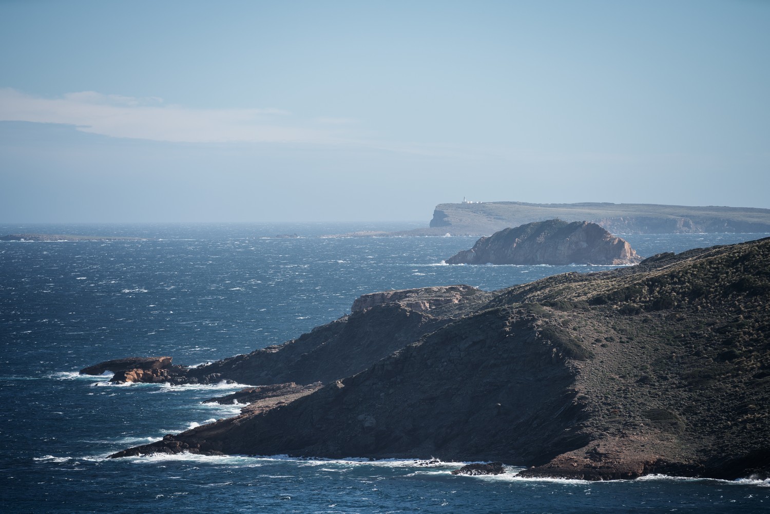
The route gets into the wildest section of the Menorcan coastline and the most isolated area on the entire island. Cliffs, unspoiled coves and a well-preserved coastline, which is the maritime nucleus of the Biosphere Reserve. This is the scene of the biggest elevation gain of the whole route, which is concentrated at the end of a hard stage.
Camí de Cavalls 360º offers a good number of modalities, formulas and formats for participants to enjoy the route with a path adapted to their pace, level and time availability. The Hiking and Trekking 10 stages program is one of the best suited to hikers with some experience and looking for medium difficulty routes.
The 185 kilometers of distance and 2,741 meters of elevation gain are divided into ten feasible days of about twenty kilometers on average. Participants should only think about enjoying the landscapes and spots through their path. The organization team will take care of the rest: advice on the route and possible variants, logistical issues and even transfers to accommodation when it is not possible to reach them walking.
STAGE #02: FAVÀRITX – SES SALINES DE FORNELLS
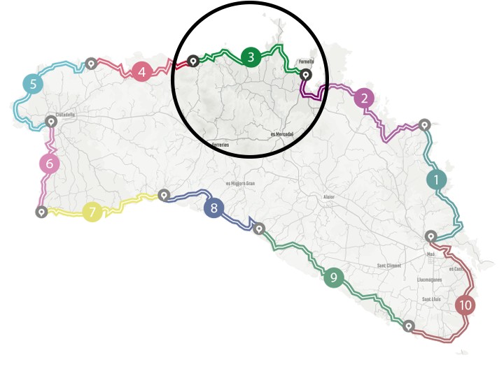
STAGE #03: SES SALINES DE FORNELLS – CAMÍ DES ALOCS
STAGE #04: CAMÍ DES ALOCS – CALA MORELL
STAGE #05: CALA MORELL – CIUTADELLA
STAGE #06: CIUTADELLA – CAP D’ARTRUTX
STAGE #07: CAP D’ARTUTX – CALA GALDANA
STAGE #08: CALA GALDANA – SON BOU
STAGE #09: SON BOU – BINIBÈQUER VELL
STAGE #10: BINIBÈQUER VELL – MAÓ
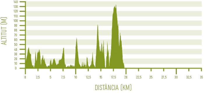
Distance: 21,75 km / Elevation gain: 671 m
The beginning of the stage is misleading and does not anticipate what will come next. This initial section runs for 1.4 kilometers along the sidewalk attached to the access road of the Platges de Fornells residential area and then goes through streets to Cala Tirant. There, it leaves the asphalt to cross this renowned beach.
From Cala Tirant to Platja de Cavalleria
After a brief inland detour along wide tracks, the route returns to the coast, where a narrow path skirts the coastline for more than two kilometers. In this part of the route you will find the largest endemic concentration of socarrells on the entire island, as well as the geologically oldest area of Menorca.
The strongly folded, parallel layer sediments of slab and sandstones that outcrop here belong to the Lower Devonian period, dating up to 400 million years ago. They can be easily seen when passing through the lovely coves of Macar Petit and Macar Gran.
The path turns inland to cross the isthmus of Cap de Cavalleria peninsula. Its famous lighthouse and cliffs are about 2.6 kilometers north of the GR route. To get there, you have to go right along the road where the trail ends.
At this point, you you can see the natural port of Sanitja and the remains of the Roman city of Sanicera, which, together with Mago (Maó) and Iamo (Ciutadella), made up the empire’s network on the island. Its heyday lasted between 123 BC and the third century of our era.
The Camí de Cavalls 360º route follows the road to the left for 1.3 kilometers, until it reaches the Platja de Cavalleria car park. You have to cross it to regain the seafront.
From Platja de Cavalleria to Binimel·là
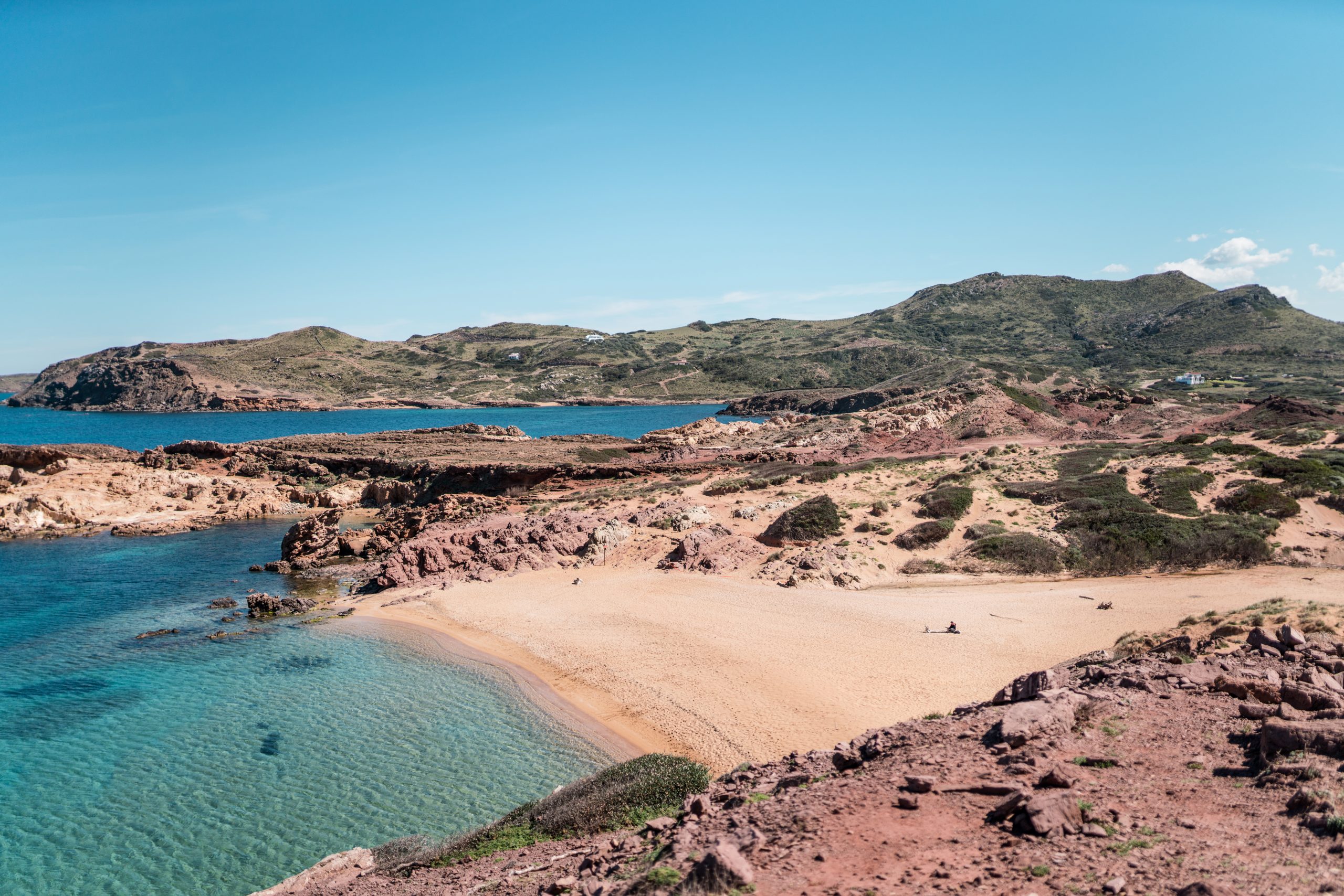
The path runs along the coastline from Platja de Cavalleria to the wild and inhospitable Cala Mica. Here you can see an example of caseta de vorera, small fishermen’s refuges built next to the sea in a traditional way. They are quite common in Menorca.
From here, you have to climb one of the slopes of the Binimel·là hill, in a premonitory effort of what will come later. Platja de Binimel·là arrives as a pleasant oasis. Its restaurant, located about 300 meters from the water, is open almost every day during the sun and beach tourist season and offers some consolation to face the sun that burns this entire stretch with no shadows.
This area of the island is part of the European natural declaration SCI (Site of Community Importance) and SPA (Special Protection Area).
From Binimel·là to Cala Barril
The ups and downs continue, while the route follows a beautiful unspoiled coastline section and the landscapes demand attention at every turn. Shortly after Binimel·là, Calesmorts is a small cove with a seabed that combines sand and rocks. It is the habitat of delicate communities of Cytoseira algae spice, which is an excellent sign of water quality.
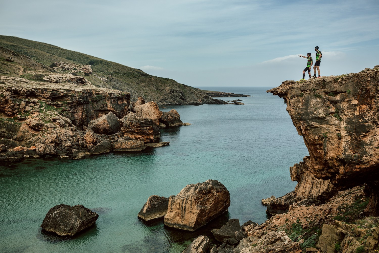
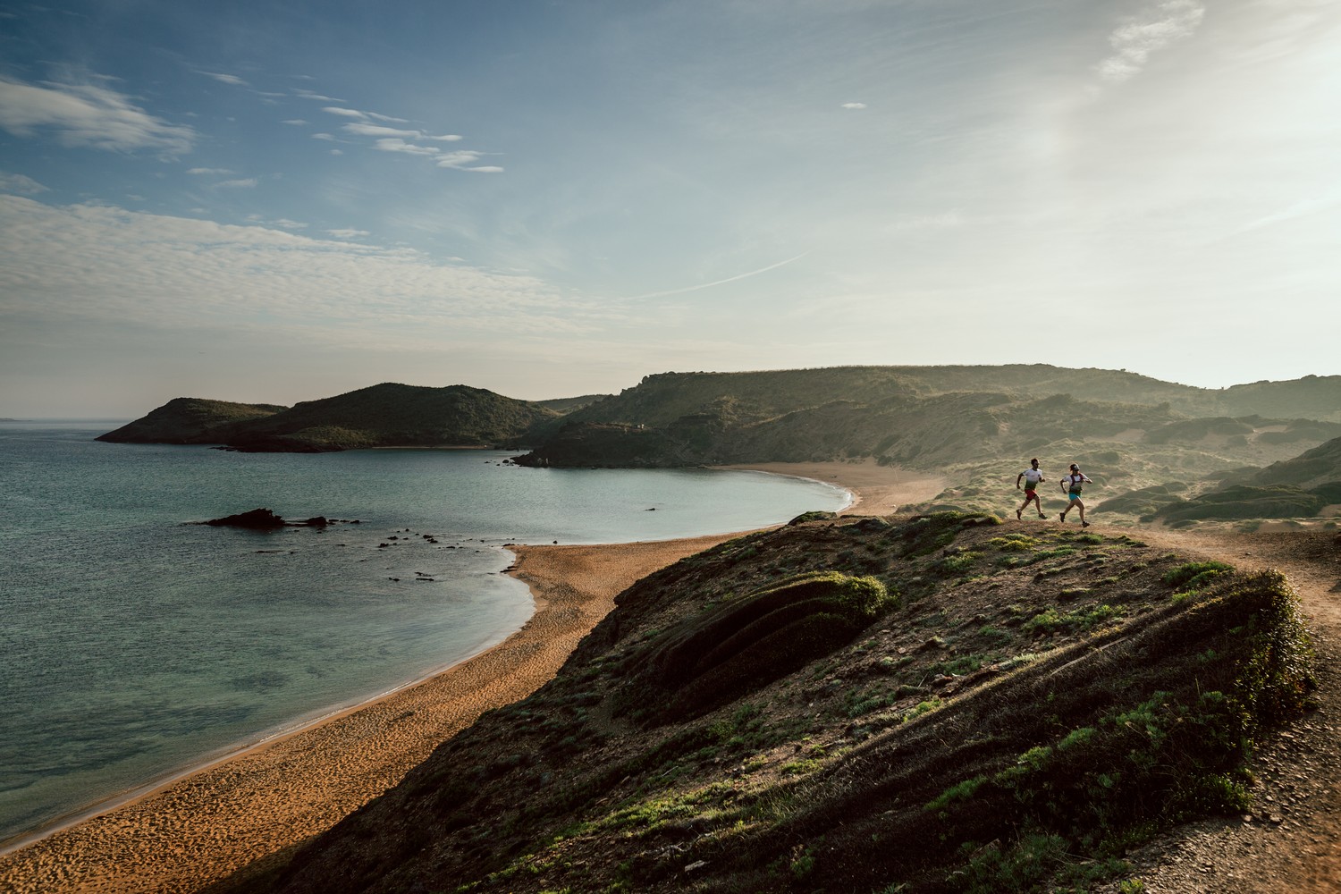
The next highlights of the path are the beaches of Cala Pregondó and Cala Pregonda. The latter is one of the most emblematic of the island, thanks to its golden sand, its turquoise waters and the whimsical shapes of the subvolcanic islets of Penyes Blanques in its horizon, resulting in a postcard landscape.
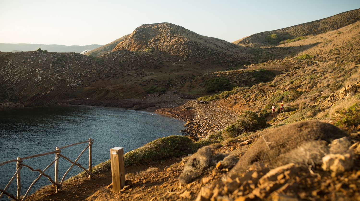
A pine forest provides a bit of shade along the kilometer that separates Cala Pregonda from Cala Barril. From its lonely beach of dark rock, Illa de ses Bledes can be perfectly seen. Here begins the nuclear section of the Reserva Marina del Nord de Menorca. Up to the Pla de Mar area, it is protected as an integral reserve in which, therefore, all kinds of fishing or flora and fauna extraction are prohibited. It is also the maritime nucleus of the Biosphere Reserve.
From Cala Barril to Camí des Alocs
Also in Cala Barril the hardest section of the Camí de Cavalls 360º begins, with two of the most demanding climbs of the entire route. In addition, there is no shade at all, as you go through hills with low vegetation.
The first slope overcomes more than eighty meters of elevation in a short distance, before descending again to the small beach of fine white sand of Cala en Calderer. It is one of the loneliest coves in Menorca, given its difficult access.
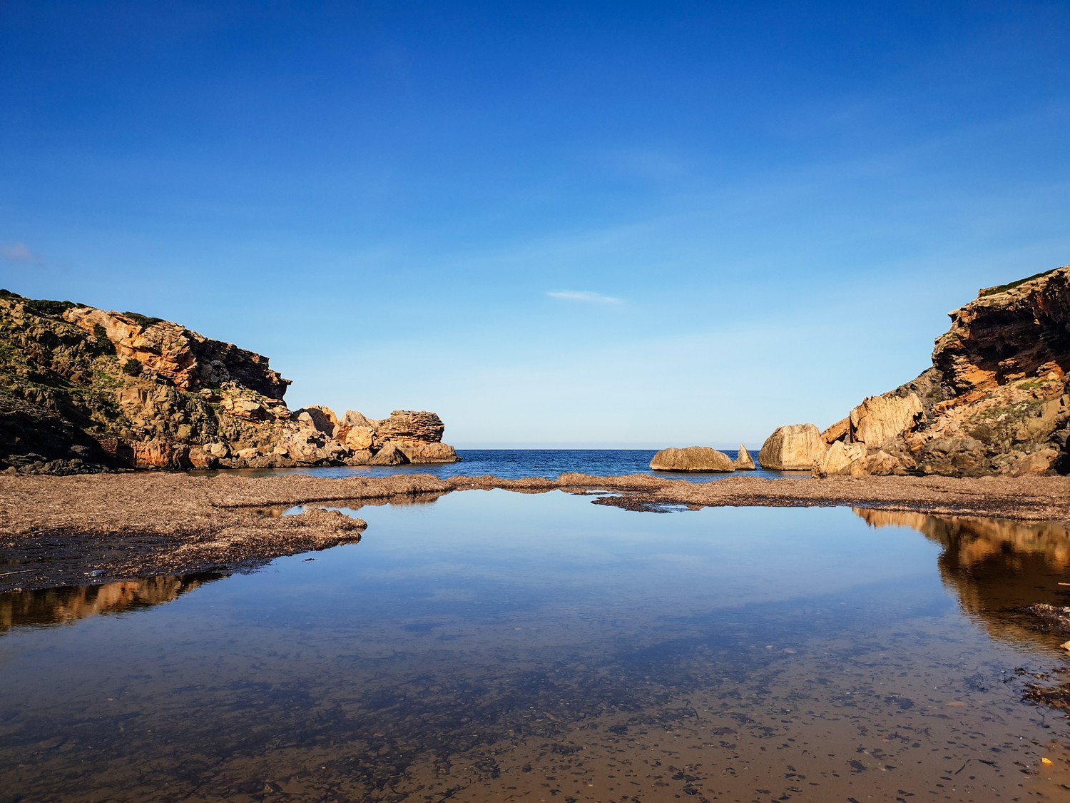
Another fifty meters climb is the prelude to the ascent to the Marina de Son Ermità, which culminates at 135 meters above sea level. This is the highest point on the entire route. A long descent goes back to the seafront at Es Alocs, a wild and inhospitable pebble beach. The stage ends about 2.5 kilometers from the cove, at the highest point of Camí des Alocs.