Ravines still are the common thread of this route’s stage that follows part of the island’s coastline. The Barranc de Cala en Porter ravine stands out as the longest in Menorca. The path borders farmland and passes near some of the most notable Talayotic sites, such as the town of Torre d’en Galmés and the Calescoves necropolis. The final section reaches tourist villages such as Binissafúller and Binibèquer.
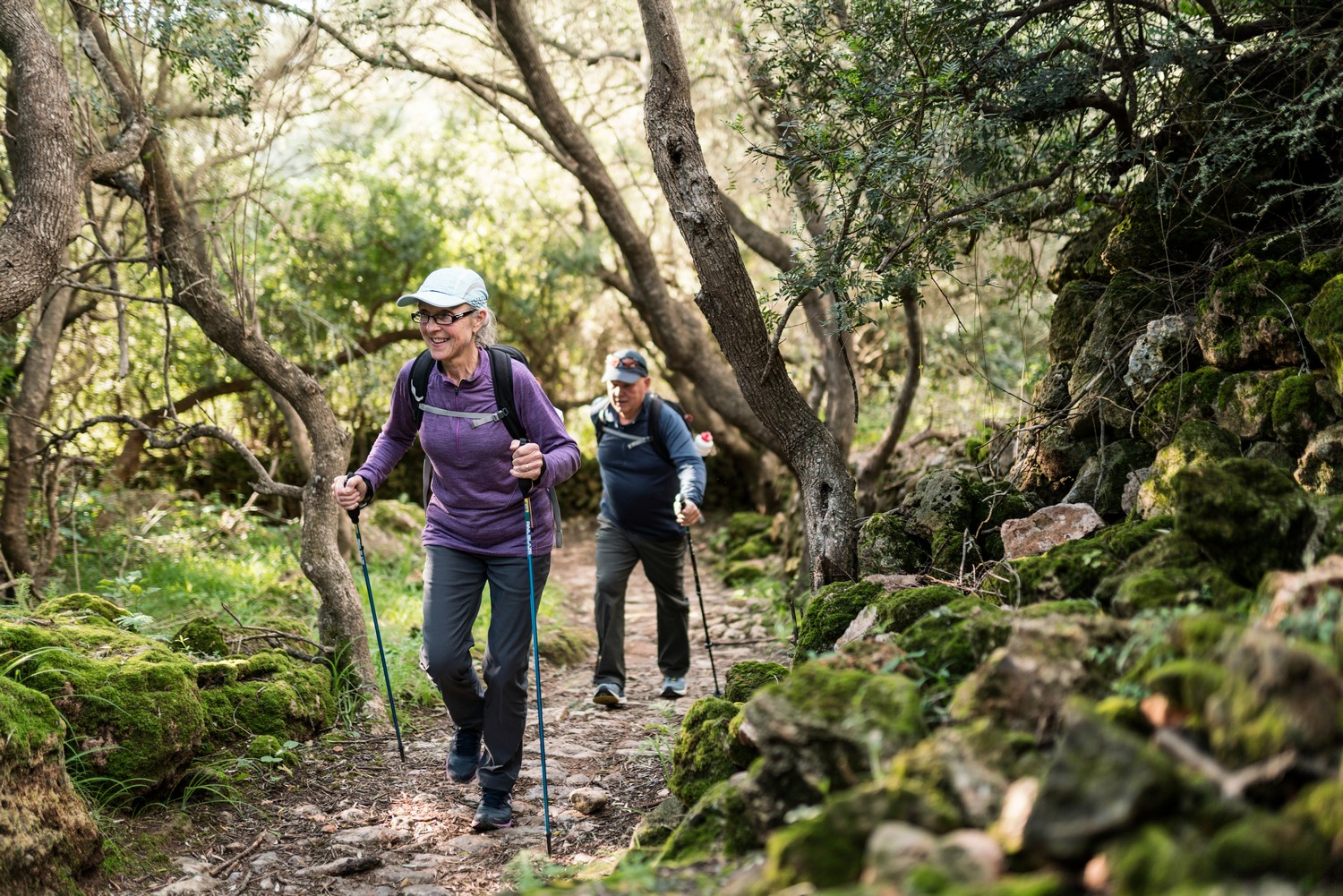
Camí de Cavalls 360º offers a good number of modalities, formulas and formats for participants to enjoy the route with a path adapted to their pace, level and time availability. The Hiking and Trekking 10 stages program is one of the best suited to hikers with some experience and looking for medium difficulty routes.
The 185 kilometers of distance and 2,741 meters of elevation gain are divided into ten feasible days of about twenty kilometers on average. Participants should only think about enjoying the landscapes and spots through their path. The organization team will take care of the rest: advice on the route and possible variants, logistical issues and even transfers to accommodation when it is not possible to reach them walking.
STAGE #02: FAVÀRITX – SES SALINES DE FORNELLS
STAGE #03: SES SALINES DE FORNELLS – CAMÍ DES ALOCS
STAGE #04: CAMÍ DES ALOCS – CALA MORELL
STAGE #05: CALA MORELL – CIUTADELLA
STAGE #06: CIUTADELLA – CAP D’ARTRUTX
STAGE #07: CAP D’ARTUTX – CALA GALDANA
STAGE #08: CALA GALDANA – SON BOU
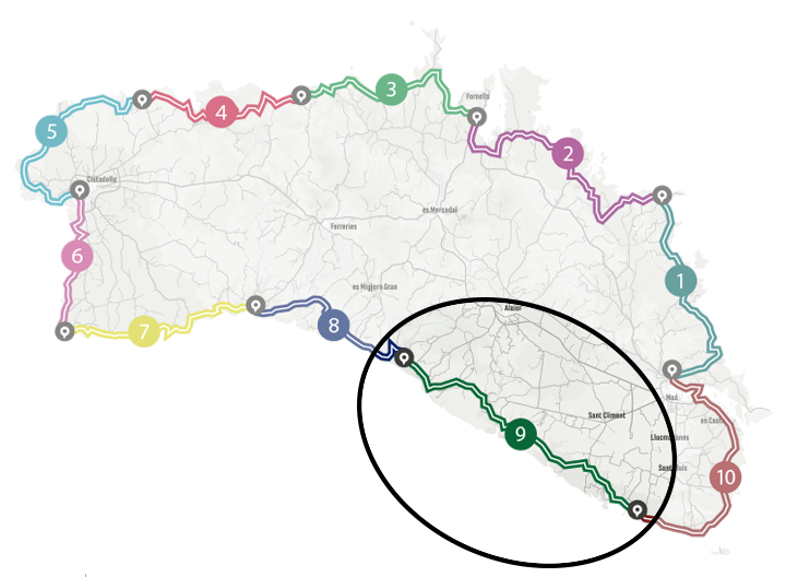
STAGE #09: SON BOU – BINIBÈQUER VELL
STAGE #10: BINIBÈQUER VELL – MAÓ
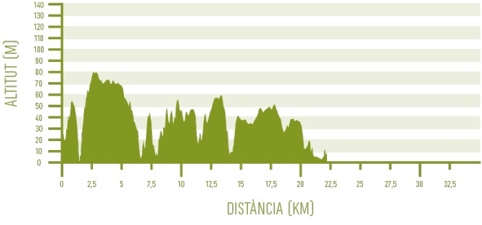
Distance: 22,43 km / Elevation gain: 300 m
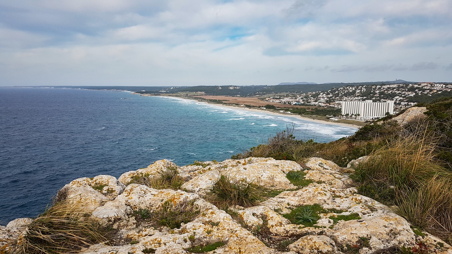
The path goes decidedly up since it leaves Son Bou behind. It climbs up a promontory where, before going down the other side, it is advisable to turn off about 500 meters to the right to Cap de ses Penyes to enjoy the views. You can see, on one side, the Son Bou beach and, on the other, the Llucalari cove and ravine.
From Cala de Llucalari to Cala en Porter
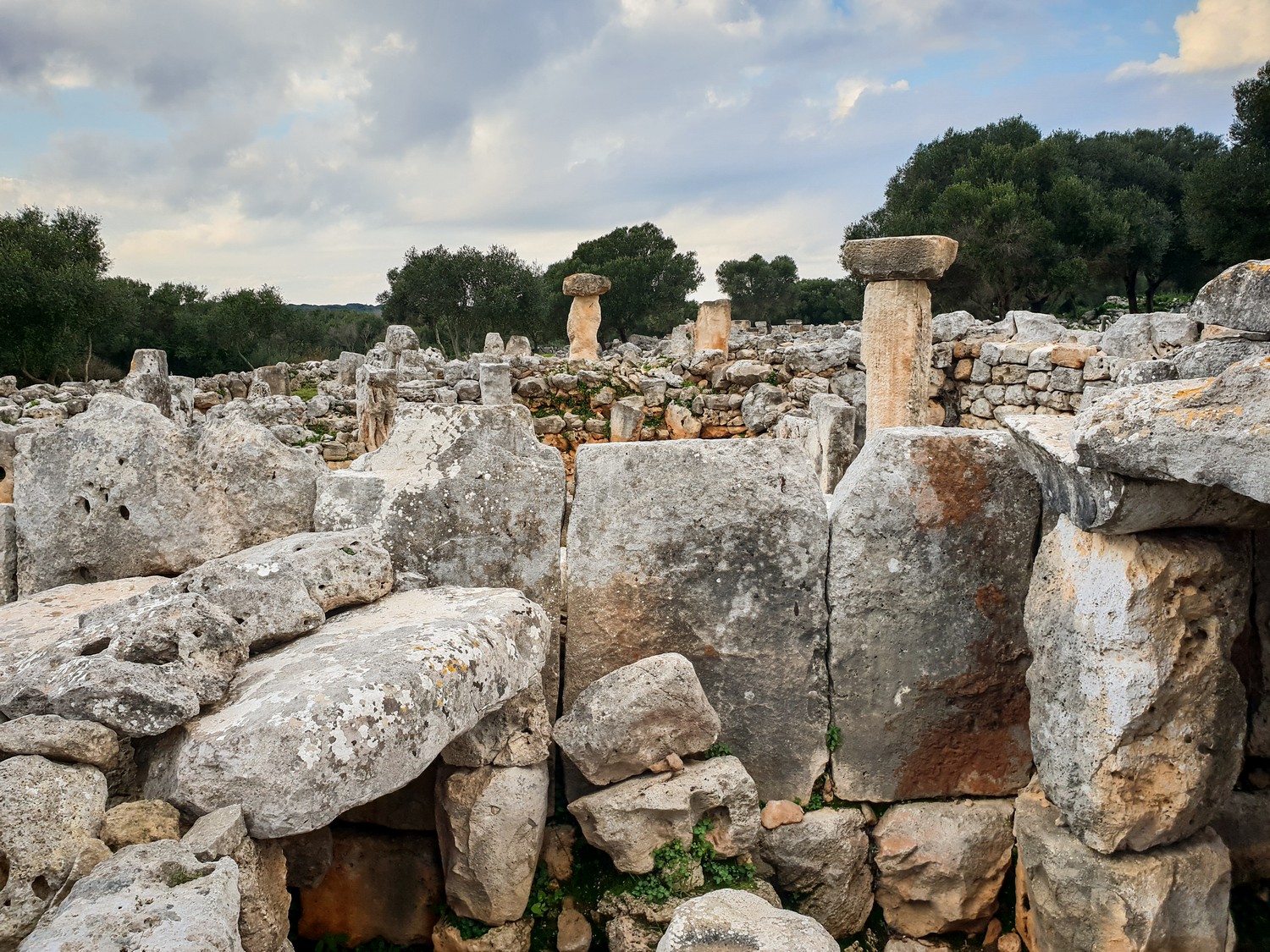
Once on the rocky beach of Cala de Llucalari, you have to go up the ravine of the same name to get out of it. An environment of cultivated fields leads to the next ravine, the Barranc de la Torre Vella, which must be crossed from its upper part. The fields continue to star in this landscape, leading to a wide track. This point is one kilometer away from the Talayotic settlement of Torre d’en Galmés, the largest in Menorca, which has a great diversity of constructions, including three talayots.
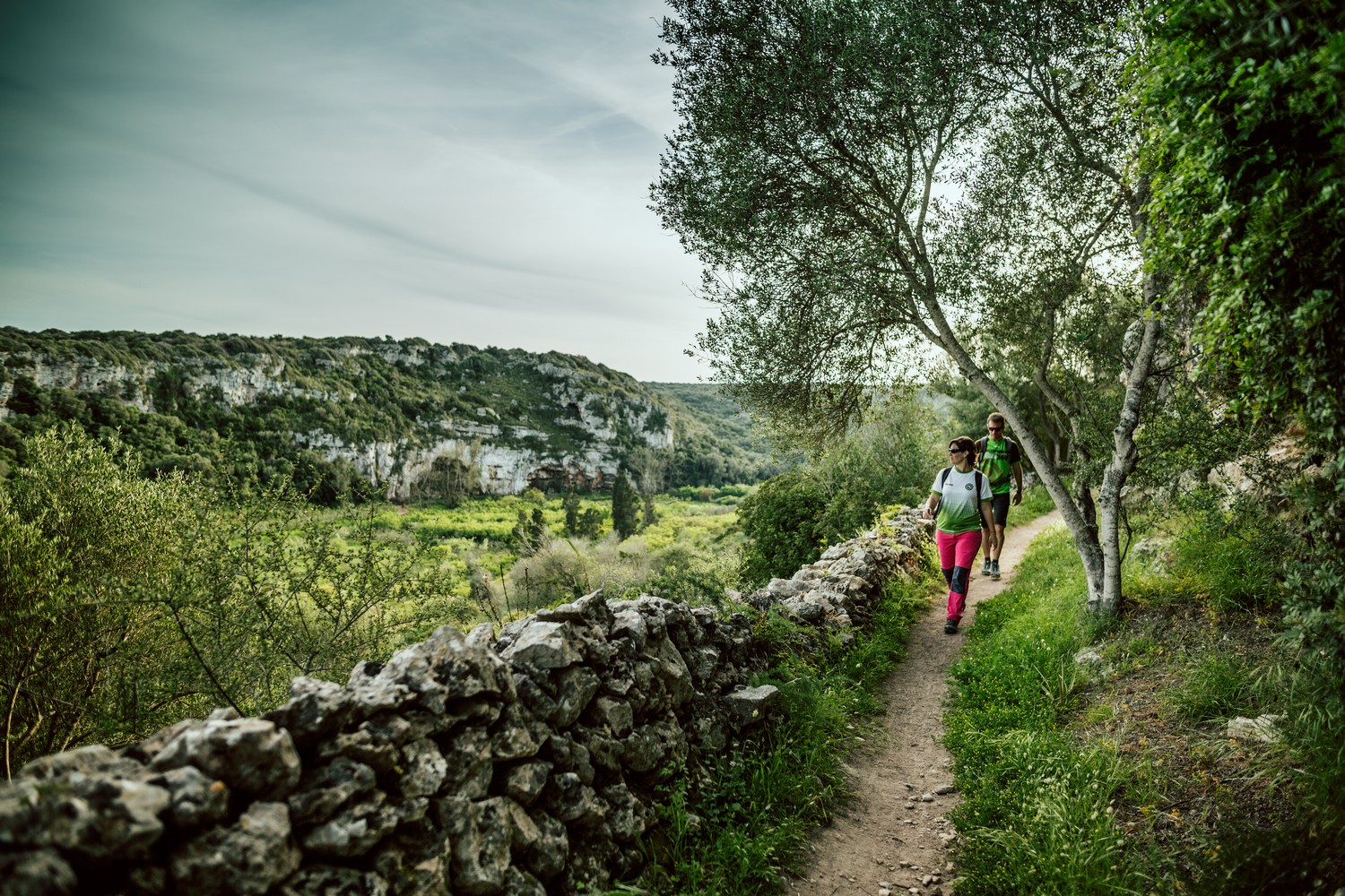
The Camí de Cavalls, however, continues in the opposite direction, to go in search of the Barranc de Cala en Porter. The twelve kilometers in length of this ravine are an ethnological example, since it has been used since time immemorial for the cultivation of fruit trees and orchards, especially recognized during the time of Muslim rule between the 10th and 13th centuries.
It is therefore worth paying attention to unique trees, such as the exotic Pecan of S’Hort Esquella, twenty meters high. Likewise, it is worth admiring the vertical walls that close off the ravine at some points, where plants and birds compete for the best spots to root or set up their nests.
Shortly before the ravine empties into the cove, the path reaches the beach car park and turns left, down a street in the Cala en Porter residential area.
From Cala en Porter to Es Canutells
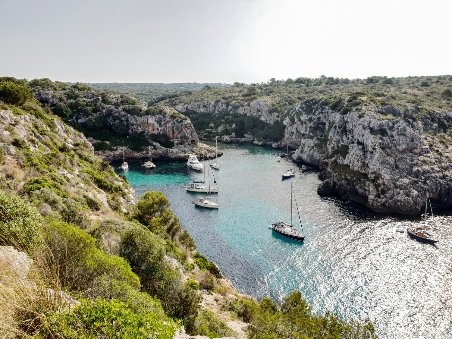
The GR marks are useful to guide you through this residential and tourist area. Once on the other side, you have to cross the Barranc de Son Domingo and begin the descent towards Calescoves. The Camí de Cavalls does not exactly reach this double cove, although it is advisable to deviate the 300 meters that take it away from the route, so being able to admire the largest Talayotic necropolis on the island. More than a hundred caves and hypogea have been catalogued, as well as the remains of a prehistoric wall and a small Roman settlement.
Again, you have to go up a ravine before going down the next one, through crop fields and pastures. Just before reaching Cala des Canutells, the elm forest found in this small ravine is surprising. This cove combines the tourist character with the fishing personality and has the curious presence of a ducks colony.
From Es Canutells to Binibèquer Vell
A stretch of almost two kilometers of asphalt places the path between more crop fields and pastures –many of them abandoned–, next to the fortified llocs of Sargossam and Santa Catalina. The Binidalí and Biniparratx ravines are the last ones before entering fully into the landscape of the Menorcan countryside in the south of Maó. Here, the dry stone gets the highest importance, with an endless series of walls erected to separate plots.
The path descends towards a paved road on the seafront, at Binissafúller. The route goes left, but right there on the right hand side there is the tiny cove known as Caló Blanc, highly recommended. Some 500 meters of asphalt further on is Cala de Binissafúller, a quiet beach in a residential setting.
The end of the stage is located in Binibèquer Vell, a residential area built in 1972 reproducing the typical architecture of a Mediterranean fishing village. It had such a success that for years it has been one of the most visited places in Menorca.
Paved section around Es Canutells area (Photo: Jordi Saragossa).